Area Overview for S72 8PW
Photos of S72 8PW
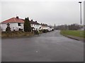
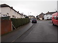
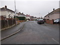
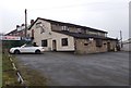
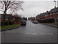
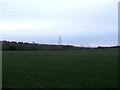
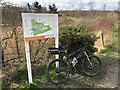
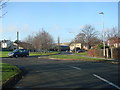
22 photos from this area
Area Information
Key information about the S72 8PW including its size, population, and administrative classification.
- Area Type
- Postcode
- Area Size
- 23.2 hectares
- Population
- 1576
- Population Density
- 805 people/km²
House Prices in S72 8PW
82
Properties
£90,908
Average Sold Price
£27,500
Lowest Price
£155,000
Highest Price
Showing 82 properties
| Address | Type | Beds | Baths | Last Sale Price | Last Sale Date | |
|---|---|---|---|---|---|---|
| 7 The Green View, Shafton, Barnsley, S72 8PW | Semi-detached | 3 | 1 | £155,000 | Dec 2024 | |
| 65 The Green View, Shafton, Barnsley, S72 8PW | Semi-detached | 3 | 1 | £145,000 | Oct 2023 | |
| 6 The Green View, Shafton, Barnsley, S72 8PW | house | - | - | £140,000 | Aug 2022 | |
| 50 The Green View, Shafton, Barnsley, S72 8PW | Semi-detached | 3 | 1 | £135,000 | May 2022 | |
| 22 The Green View, Shafton, Barnsley, S72 8PW | house | - | - | £115,000 | May 2022 | |
| 17 The Green View, Shafton, Barnsley, S72 8PW | Retail | 3 | 1 | £140,000 | Apr 2022 | |
| 58 The Green View, Shafton, Barnsley, S72 8PW | Semi-detached | 3 | 1 | £101,000 | Oct 2020 | |
| 46 The Green View, Shafton, Barnsley, S72 8PW | Semi-detached | 3 | 1 | £107,500 | Apr 2018 | |
| 73 The Green View, Shafton, Barnsley, S72 8PW | Semi-detached | 3 | 1 | £107,000 | Aug 2017 | |
| 15 The Green View, Shafton, Barnsley, S72 8PW | Semi-detached | - | - | £115,000 | Jul 2016 |
Page 1 of 9
Energy Efficiency in S72 8PW
Amenities
Schools
| Rank | School | Type | Entry gender | Ages |
|---|
Explore more schools in this area
Go to Schools tabDemographics
Household Size
Family (3-5 people)
most common
Accommodation Type
Houses
most common
Tenure
68
majority
Ethnic Group
White
most common
Religion
N/A
most common
Household Composition
N/A
most common
Age
47
median
Adults (30-64 years)
most common
Household Deprivation
N/A
with no deprivation
NS-SEC
22
in Lower managerial occupations
Explore more demographic insights in this area
Go to Demographics tabPlanning
Planning Constraints
- Flood RiskPremium
- Ramsar Wetland SitesPremium
- Area of Outstanding Natural BeautyPremium
- Protected Nature ReservePremium
- Protected WoodlandPremium