Area Overview for S72 8JZ
Photos of S72 8JZ
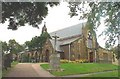
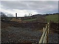
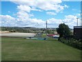
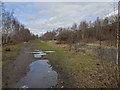
34 photos from this area
Area Information
Key information about the S72 8JZ including its size, population, and administrative classification.
- Area Type
- Postcode
- Area Size
- 2727 m²
- Population
- 1602
- Population Density
- 3342 people/km²
House Prices in S72 8JZ
18
Properties
£77,859
Average Sold Price
£26,000
Lowest Price
£105,950
Highest Price
Showing 18 properties
| Address | Type | Beds | Baths | Last Sale Price | Last Sale Date | |
|---|---|---|---|---|---|---|
| 20 Church Street, Cudworth, Barnsley, S72 8JZ | Terraced | 3 | 1 | £105,950 | Jul 2025 | |
| 28 Church Street, Cudworth, Barnsley, S72 8JZ | Terraced | 2 | 1 | £80,000 | Jul 2023 | |
| 16 Church Street, Cudworth, Barnsley, S72 8JZ | Terraced | 2 | 1 | £95,000 | Jun 2023 | |
| 12 Church Street, Cudworth, Barnsley, S72 8JZ | Semi-detached | 2 | 1 | £102,500 | Nov 2022 | |
| 14 Church Street, Cudworth, Barnsley, S72 8JZ | house | - | - | £84,500 | Aug 2022 | |
| 10A Church Street, Cudworth, Barnsley, S72 8JZ | Flat | - | - | £61,000 | Jun 2017 | |
| 22 Church Street, Cudworth, Barnsley, S72 8JZ | house | - | - | £70,000 | Feb 2010 | |
| 30A Church Street, Cudworth, Barnsley, S72 8JZ | Flat | 2 | 1 | £83,644 | Jun 2007 | |
| 18 Church Street, Cudworth, Barnsley, S72 8JZ | house | - | - | £70,000 | Nov 2006 | |
| 24 Church Street, Cudworth, Barnsley, S72 8JZ | Terraced | - | - | £26,000 | Jun 1996 |
Page 1 of 2
Energy Efficiency in S72 8JZ
Amenities
Schools
| Rank | School | Type | Entry gender | Ages |
|---|
Explore more schools in this area
Go to Schools tabDemographics
Household Size
Family (3-5 people)
most common
Accommodation Type
Houses
most common
Tenure
63
majority
Ethnic Group
White
most common
Religion
N/A
most common
Household Composition
N/A
most common
Age
47
median
Adults (30-64 years)
most common
Household Deprivation
N/A
with no deprivation
NS-SEC
18
in Lower managerial occupations
Explore more demographic insights in this area
Go to Demographics tabPlanning
Planning Constraints
- Flood RiskPremium
- Ramsar Wetland SitesPremium
- Area of Outstanding Natural BeautyPremium
- Protected Nature ReservePremium
- Protected WoodlandPremium