Area Overview for S72 7DJ
Photos of S72 7DJ
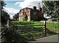
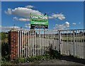
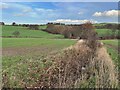
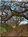
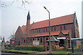
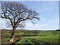
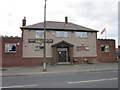
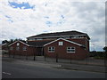
23 photos from this area
Area Information
Key information about the S72 7DJ including its size, population, and administrative classification.
- Area Type
- Postcode
- Area Size
- 1.5 hectares
- Population
- 2417
- Population Density
- 878 people/km²
House Prices in S72 7DJ
25
Properties
£76,405
Average Sold Price
£18,000
Lowest Price
£115,000
Highest Price
Showing 25 properties
| Address | Type | Beds | Baths | Last Sale Price | Last Sale Date | |
|---|---|---|---|---|---|---|
| 74 Michaels Estate, Grimethorpe, Barnsley, S72 7DJ | Bungalow | - | - | £115,000 | Jun 2024 | |
| 69 Michaels Estate, Grimethorpe, Barnsley, S72 7DJ | Bungalow | - | - | £115,000 | Jan 2023 | |
| 71 Michaels Estate, Grimethorpe, Barnsley, S72 7DJ | Bungalow | - | - | £95,000 | Feb 2022 | |
| 70 Michaels Estate, Grimethorpe, Barnsley, S72 7DJ | Bungalow | 2 | 1 | £68,500 | Jul 2017 | |
| 64 Michaels Estate, Grimethorpe, Barnsley, S72 7DJ | Bungalow | - | - | £80,000 | Nov 2013 | |
| 66 Michaels Estate, Grimethorpe, Barnsley, S72 7DJ | Bungalow | - | - | £83,000 | Jul 2010 | |
| 78 Michaels Estate, Grimethorpe, Barnsley, S72 7DJ | Bungalow | 2 | - | £82,000 | Feb 2010 | |
| 68 Michaels Estate, Grimethorpe, Barnsley, S72 7DJ | Terraced | - | - | £73,000 | Dec 2008 | |
| 72 Michaels Estate, Grimethorpe, Barnsley, S72 7DJ | Bungalow | - | - | £82,950 | Jul 2007 | |
| 65 Michaels Estate, Grimethorpe, Barnsley, S72 7DJ | Bungalow | - | - | £18,000 | Apr 2004 |
Page 1 of 3
Energy Efficiency in S72 7DJ
Amenities
Schools
| Rank | School | Type | Entry gender | Ages |
|---|
Explore more schools in this area
Go to Schools tabDemographics
Household Size
Family (3-5 people)
most common
Accommodation Type
Houses
most common
Tenure
49
majority
Ethnic Group
White
most common
Religion
N/A
most common
Household Composition
N/A
most common
Age
47
median
Adults (30-64 years)
most common
Household Deprivation
N/A
with no deprivation
NS-SEC
15
in Lower managerial occupations
Explore more demographic insights in this area
Go to Demographics tabPlanning
Planning Constraints
- Flood RiskPremium
- Ramsar Wetland SitesPremium
- Area of Outstanding Natural BeautyPremium
- Protected Nature ReservePremium
- Protected WoodlandPremium