Area Overview for S72 0AT
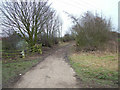
Photos of S72 0AT
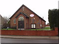
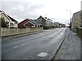
![Houses on the west side of High Street [B6273] in S72 0AT](https://images.propbar.co.uk/images/geograph/52/52/5252338_120.jpg)


31 photos from this area
Area Information
Key information about the S72 0AT including its size, population, and administrative classification.
- Area Type
- Postcode
- Area Size
- 7.9 hectares
- Population
- 1641
- Population Density
- 302 people/km²
House Prices in S72 0AT
11
Properties
£219,167
Average Sold Price
£80,000
Lowest Price
£485,000
Highest Price
Showing 11 properties
| Address | Type | Beds | Baths | Last Sale Price | Last Sale Date | |
|---|---|---|---|---|---|---|
| 61 High Street, Great Houghton, Barnsley, S72 0AT | Bungalow | 3 | 3 | £485,000 | Aug 2024 | |
| 49 High Street, Great Houghton, Barnsley, S72 0AT | Terraced | - | - | £80,000 | Nov 2022 | |
| 59A High Street, Great Houghton, Barnsley, S72 0AT | Bungalow | 4 | 2 | £295,000 | Jul 2021 | |
| 53 High Street, Great Houghton, Barnsley, S72 0AT | house | - | - | £185,000 | Nov 2020 | |
| 57 High Street, Great Houghton, Barnsley, S72 0AT | Detached | 3 | 2 | £188,000 | Dec 2016 | |
| 59 High Street, Great Houghton, Barnsley, S72 0AT | house | - | - | £82,000 | Jul 2000 | |
| 47 High Street, Great Houghton, Barnsley, S72 0AT | Terraced | - | - | - | - | |
| Pear Tree Cottage, 55 High Street, Great Houghton, Barnsley, S72 0AT | Semi-detached | - | - | - | - | |
| 43 High Street, Great Houghton, Barnsley, S72 0AT | Terraced | - | - | - | - | |
| 63 High Street, Great Houghton, Barnsley, S72 0AT | house | - | - | - | - |
Page 1 of 2
Energy Efficiency in S72 0AT
Amenities
Schools
| Rank | School | Type | Entry gender | Ages |
|---|
Explore more schools in this area
Go to Schools tabDemographics
Household Size
Two person
most common
Accommodation Type
Houses
most common
Tenure
71
majority
Ethnic Group
White
most common
Religion
N/A
most common
Household Composition
N/A
most common
Age
47
median
Adults (30-64 years)
most common
Household Deprivation
N/A
with no deprivation
NS-SEC
21
in Lower managerial occupations
Explore more demographic insights in this area
Go to Demographics tabPlanning
Planning Constraints
- Flood RiskPremium
- Ramsar Wetland SitesPremium
- Area of Outstanding Natural BeautyPremium
- Protected Nature ReservePremium
- Protected WoodlandPremium