Area Overview for S71 5LL
Photos of S71 5LL
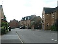
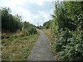
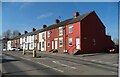
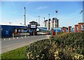
30 photos from this area
Area Information
Key information about the S71 5LL including its size, population, and administrative classification.
- Area Type
- Postcode
- Area Size
- 2.6 hectares
- Population
- 2626
- Population Density
- 2056 people/km²
House Prices in S71 5LL
50
Properties
£136,684
Average Sold Price
£55,000
Lowest Price
£315,000
Highest Price
Showing 50 properties
| Address | Type | Beds | Baths | Last Sale Price | Last Sale Date | |
|---|---|---|---|---|---|---|
| 82 Parkland View, Lundwood, Barnsley, S71 5LL | Detached | 4 | 2 | £315,000 | Aug 2024 | |
| 46 Parkland View, Lundwood, Barnsley, S71 5LL | house | - | - | £230,000 | Mar 2022 | |
| 90 Parkland View, Lundwood, Barnsley, S71 5LL | house | - | - | £220,000 | Apr 2021 | |
| 26 Parkland View, Lundwood, Barnsley, S71 5LL | Flat | - | - | £60,500 | Mar 2021 | |
| 52 Parkland View, Lundwood, Barnsley, S71 5LL | Detached | 3 | - | £137,410 | Jan 2021 | |
| 24 Parkland View, Lundwood, Barnsley, S71 5LL | Flat | - | - | £65,000 | Mar 2020 | |
| 14 Parkland View, Lundwood, Barnsley, S71 5LL | Flat | - | - | £62,000 | Dec 2019 | |
| 54 Parkland View, Lundwood, Barnsley, S71 5LL | Detached | 4 | 3 | £195,000 | Aug 2019 | |
| 22 Parkland View, Lundwood, Barnsley, S71 5LL | Flat | - | - | £55,000 | Jun 2019 | |
| 94 Parkland View, Lundwood, Barnsley, S71 5LL | Detached | 4 | 2 | £220,000 | May 2016 |
Page 1 of 5
Energy Efficiency in S71 5LL
Amenities
Schools
| Rank | School | Type | Entry gender | Ages |
|---|
Explore more schools in this area
Go to Schools tabDemographics
Household Size
Family (3-5 people)
most common
Accommodation Type
Houses
most common
Tenure
70
majority
Ethnic Group
White
most common
Religion
N/A
most common
Household Composition
N/A
most common
Age
47
median
Adults (30-64 years)
most common
Household Deprivation
N/A
with no deprivation
NS-SEC
25
in Lower managerial occupations
Explore more demographic insights in this area
Go to Demographics tabPlanning
Planning Constraints
- Flood RiskPremium
- Ramsar Wetland SitesPremium
- Area of Outstanding Natural BeautyPremium
- Protected Nature ReservePremium
- Protected WoodlandPremium