Area Overview for S71 5LD
Photos of S71 5LD
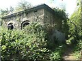
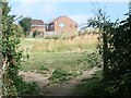
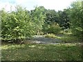
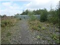

34 photos from this area
Area Information
Key information about the S71 5LD including its size, population, and administrative classification.
- Area Type
- Postcode
- Area Size
- 5.0 hectares
- Population
- 2626
- Population Density
- 2056 people/km²
House Prices in S71 5LD
32
Properties
£108,838
Average Sold Price
£18,600
Lowest Price
£270,000
Highest Price
Showing 32 properties
| Address | Type | Beds | Baths | Last Sale Price | Last Sale Date | |
|---|---|---|---|---|---|---|
| 27 Station Road, Lundwood, Barnsley, S71 5LD | Detached | 3 | 1 | £195,000 | Jul 2025 | |
| 29 Station Road, Lundwood, Barnsley, S71 5LD | house | 3 | 1 | £162,000 | May 2022 | |
| 36 Station Road, Lundwood, Barnsley, S71 5LD | Semi-detached | 3 | 1 | £120,000 | Aug 2020 | |
| Whiteoaks, 30 Station Road, Lundwood, Barnsley, S71 5LD | Semi-detached | 3 | 1 | £127,000 | Apr 2020 | |
| 47 Station Road, Lundwood, Barnsley, S71 5LD | Terraced | 2 | 1 | £92,500 | Nov 2019 | |
| 39 Station Road, Lundwood, Barnsley, S71 5LD | Terraced | 3 | 1 | £70,000 | Dec 2017 | |
| 14 Station Road, Lundwood, Barnsley, S71 5LD | house | - | - | £105,000 | Sep 2017 | |
| 35 Station Road, Lundwood, Barnsley, S71 5LD | Terraced | 3 | - | £93,500 | Nov 2016 | |
| The Vines, 14A Station Road, Lundwood, Barnsley, S71 5LD | Detached | 4 | - | £270,000 | Dec 2015 | |
| Raymount, 26 Station Road, Lundwood, Barnsley, S71 5LD | house | 4 | - | £157,000 | Mar 2015 |
Page 1 of 4
Energy Efficiency in S71 5LD
Amenities
Schools
| Rank | School | Type | Entry gender | Ages |
|---|
Explore more schools in this area
Go to Schools tabDemographics
Household Size
Family (3-5 people)
most common
Accommodation Type
Houses
most common
Tenure
70
majority
Ethnic Group
White
most common
Religion
N/A
most common
Household Composition
N/A
most common
Age
47
median
Adults (30-64 years)
most common
Household Deprivation
N/A
with no deprivation
NS-SEC
25
in Lower managerial occupations
Explore more demographic insights in this area
Go to Demographics tabPlanning
Planning Constraints
- Flood RiskPremium
- Ramsar Wetland SitesPremium
- Area of Outstanding Natural BeautyPremium
- Protected Nature ReservePremium
- Protected WoodlandPremium