Area Overview for S71 4LB
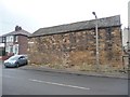
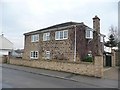
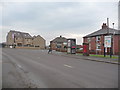
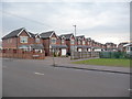
Photos of S71 4LB
Area Information
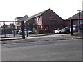
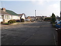
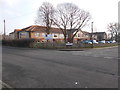
S71 4LB is a defined postcode area covering a small residential cluster of just 1.2 hectares. This compact footprint supports a population of 1,611 residents, creating a tightly knit environment where neighbours know each other well. The density here is remarkably high at 133,319 people per square kilometre, which reflects the sheer size of the postcode rather than chaotic urban building. You will find a community that values proximity and local knowledge over the noise of large cities. Living in S71 4LB means navigating a neighbourhood where everyday life moves at a manageable pace despite the high concentration of households. The area exists as a specific residential zone south-east of Manchester, offering a quiet retreat from wider regional traffic while maintaining easy access to surrounding services. It is a place where the distinction between your front door and the village shop is short, making it ideal for those who appreciate a walkable lifestyle without the sprawl of a major metropolitan development. The small area size ensures that everything of practical importance is within easy reach, fostering a sense of convenience that larger districts often lack.
- Area Type
- Postcode
- Area Size
- 1.2 hectares
- Population
- 1611
- Population Density
- 3833 people/km²
S71 4LB presents a distinct picture of the property market for prospective buyers. With a home ownership rate of 46 per cent, the area sits in the middle ground between purely investor-led rental zones and communities where every house is occupied by its owner. This balance often stabilises property values and gives residents a strong stake in the local environment. Houses dominate the accommodation landscape, which means you are likely to encounter traditional linked houses or detached bungalows typical of the region rather than high-rise apartments. The small size of the postcode at 1.2 hectares limits the volume of available stock, meaning competition for specific properties could be fierce if you are looking for something exact. Buyers viewing homes in this area should be prepared to move quickly, as the inventory is restricted by the small geographical boundary. The prevalence of house ownership suggests that many current owners have added value to their properties over time. This context helps explain why TPOs or conservation constraints might appear in nearby areas, even though S71 4LB specifically does not have protected woodland.
House Prices in S71 4LB
Showing 44 properties
| Address | Type | Beds | Baths | Last Sale Price | Last Sale Date | |
|---|---|---|---|---|---|---|
| 108 Doles Crescent, Royston, Barnsley, S71 4LB | Semi-detached | 3 | 1 | £129,000 | Oct 2023 | |
| 148 Doles Crescent, Royston, Barnsley, S71 4LB | house | - | - | £115,000 | Dec 2022 | |
| 98 Doles Crescent, Royston, Barnsley, S71 4LB | Semi-detached | 3 | 1 | £110,000 | Nov 2022 | |
| 114 Doles Crescent, Royston, Barnsley, S71 4LB | house | - | - | £130,000 | May 2022 | |
| 118 Doles Crescent, Royston, Barnsley, S71 4LB | Semi-detached | - | - | £80,000 | Aug 2008 | |
| 110 Doles Crescent, Royston, Barnsley, S71 4LB | Semi-detached | - | - | £83,000 | Jan 2006 | |
| 45 Doles Crescent, Royston, Barnsley, S71 4LB | Semi-detached | - | - | £18,750 | Jun 1998 | |
| 59 Doles Crescent, Royston, Barnsley, S71 4LB | Semi-detached | 3 | - | £30,000 | Sep 1997 | |
| 116 Doles Crescent, Royston, Barnsley, S71 4LB | Semi-detached | 2 | 1 | - | - | |
| 41 Doles Crescent, Royston, Barnsley, S71 4LB | Semi-detached | 3 | 1 | - | - |
Energy Efficiency in S71 4LB
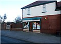
Daily life for residents of S71 4LB benefits from a cluster of nearby amenities that are all within practical reach. You will find five retail locations close by, including Aldi High, Co-op Royston, and Spar Royston. These specific venues offer everything from fresh produce to household essentials, meaning most shopping runs can be completed without a car. The area also boasts five rail connections nearby, with stations at Darton, Barnsley, and Fitzwilliam providing access to wider networks. While the nearest stations are not detailed as being directly adjacent, their presence indicates easy rail access for commuting or weekend trips. The small area size of 1.2 hectares ensures that the distance to these amenities is minimal. You can walk to the Co-op or Spar easily, making nutrition and grocery shopping part of your routine. There is no data on leisure parks or gym facilities within the immediate postcode, so entertainment relies on the local railway links and the shops available at Aldi and the Co-op. This setup creates a lifestyle where errands are quick and transport options are accessible via foot or local rail services.
Amenities
Schools
Families living in S71 4LB have access to two specific primary schools that serve the immediate locality. Royston Meadstead Primary School operates as a local institution without an Ofsted rating attached to the provided data. Just outside the immediate cluster, you will find Meadstead Primary Academy, which currently holds a Satisfactory Ofsted rating. This mix indicates a choice for parents between a nearby community school and a further afield institution with a published evaluation. Both schools operate at the primary level, catering to children from Reception through Year 6. There is no data on secondary schools within the direct boundary of S71 4LB, suggesting that older children may need to travel further to high schools outside the postcode. The presence of Meadstead Primary Academy with its Satisfactory rating offers a baseline of quality assurance for parents who prioritise monitored performance standards. The concentration of primary options supports families with younger children, while the gap for secondary education implies a need to look beyond the immediate postcode for teenagers.
| Rank | School | Type | Entry gender | Ages |
|---|
Explore more schools in this area
Go to Schools tabDemographics
The community within S71 4LB reflects a mature demographic profile. The median age stands at 47 years, indicating that adults between the ages of 30 and 64 form the most common age range. This suggests the area appeals primarily to established households rather than young families or retirement communities seeking very low-density zones. Home ownership levels stand at exactly 46 per cent, meaning nearly half of the residents own their homes outright or have a mortgage, while the other half rent. Houses remain the predominant accommodation type, confirming that the stock consists mainly of detached or semi-detached properties suited to families or individuals seeking space. The predominant ethnic group is White, which aligns with the broader demographics of Northern England. There is no data provided on deprivation indices for this specific cluster, so any assessment of quality of life relies on the visible stability of the housing stock and the age profile of the occupants. This demographic mix points to a stable, long-term community where residents have established roots in the local area.
Household Size
Accommodation Type
Tenure
Ethnic Group
Religion
Household Composition
Age
Household Deprivation
NS-SEC
Explore more demographic insights in this area
Go to Demographics tabPlanning
Planning Constraints
- Flood RiskPremium
- Ramsar Wetland SitesPremium
- Area of Outstanding Natural BeautyPremium
- Protected Nature ReservePremium
- Protected WoodlandPremium