Area Overview for S71 3TG
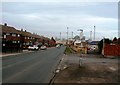
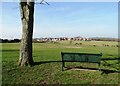
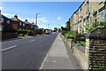
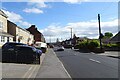
Photos of S71 3TG


Area Information
Living in S71 3TG means residing within a small, defined residential cluster covering just over nine thousand square metres. This postcode area houses 1,676 people across a compact footprint, resulting in a population density of 1,333 residents per square kilometre. The area is situated in England and serves as a tight-knit community where daily life unfolds in close quarters. Because the site is so small, most permanent residents likely know one another, creating an environment where neighbours interact frequently. The layout supports a quiet domestic pace rather than the sprawling development found in larger districts. You can expect a neighbourhood where boundaries are clear and the residential character dominates the landscape. There is little space for industrial activity within these specific coordinates, ensuring that the focus remains on housing. Buyers looking for a low-key setting will find this particular postcode area meets those needs without the noise or traffic congestion associated with broader urban zones. The manageable size means local services and shops within the immediate surroundings often suffice for daily requirements, reducing the need for long journeys before necessary amenities are in the nearby town. This concentration of homes defines the reality of life here, blending privacy with a sense of community close at hand.
- Area Type
- Postcode
- Area Size
- 9818 m²
- Population
- 1676
- Population Density
- 1333 people/km²
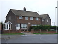
The property market in S71 3TG is distinctly characterised by a mix of home ownership and private renting. Exactly 43% of residents own their homes outright or with a mortgage, while the remaining majority reside in rented properties. This split indicates a competitive market where buyers face stiff competition if they wish to join the 43% of owner-occupiers. Houses comprise the standard accommodation type, ruling out any preference for flats or conversions within this specific postcode cluster. Prospective buyers should expect to find a stock of residential detached, semi-detached, or terraced houses depending on the street. The high density of 1,333 people per square kilometre suggests limited inventory might surface, as there is simply less land available for new developments. If you are looking to purchase, you are joining a established demographic of adults aged 30 to 64 who have made the commitment to own. The small area size of 9,818 square metres means there are few properties within the immediate S71 3TG lines, so your search may extend to adjacent streets or neighbouring postcodes to find suitable stock. The market here is not driven by luxury or prestige but by practical family housing needs.
House Prices in S71 3TG
No properties found in this postcode.
Energy Efficiency in S71 3TG
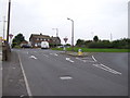
Residents of S71 3TG enjoy convenient access to a range of retail and transport hubs within practical reach. For daily shopping needs, five key retail locations are nearby, including Sainsburys Monk, Co-op Barnsley, and Farmfoods Athersley. These venues provide essential groceries and household supplies without a lengthy commute. There is also access to five railway stations, namely Barnsley Railway Station, Darton Railway Station, and Dodworth Railway Station. This rail connectivity allows for straightforward journeys to Barnsley and beyond, expanding your employment and leisure opportunities beyond the immediate postcode. The diversity of shops and stations means you can structure your weekly routine around local errands while retaining options for broader travel when necessary. Life here balances the convenience of having supermarkets and transport links close by with the tranquility of a small residential cluster. You can walk to a supermarket or step into a train station without crossing major dual carriageways or navigating chaotic roundabouts. This accessibility enhances the quality of life by reducing travel stress and saving time for family and relaxation.
Amenities
Schools
Families considering living in S71 3TG have access to two primary educational institutions within the immediate locality. St Helen's Primary School serves as a foundational option for younger children in the catchment. For those seeking a setting with a formally assessed quality of education, St Helen's Primary Academy offers a good Ofsted rating, providing reassurance regarding curriculum standards and child development. Both institutions are primary schools, meaning they focus on pupils from reception up to age 11. This mix allows parents to choose between two very similar environments, both dedicated to early education. If you are buying a home near these schools, you are positioning yourself in a zone that supports early learning stages effectively. The presence of a 'good' rated academy is a significant positive factor for parents who prioritise educational performance when selecting a neighbourhood. While there are no secondary schools listed directly within these specific boundaries, the existence of strong primary options suggests a stable educational pipeline for families moving into this area. You can expect a school environment that meets national standards for primary education without needing to travel far for key upbringing stages.
| Rank | School | Type | Entry gender | Ages |
|---|
Explore more schools in this area
Go to Schools tabDemographics
The community in S71 3TG reflects a mature population profile with a median age of 47 years. The most common age group comprises adults between 30 and 64 years old, indicating a neighbourhood dominated by working professionals and established families rather than young students or retirees. Over 43% of households have successfully secured home ownership, suggesting a degree of financial stability among residents. The remaining households likely include renters or those still navigating the property ladder. Houses form the primary mode of accommodation in this area, meaning you are looking at traditional family homes rather than purpose-built flats or terraced apartments. The predominant ethnic group is White, which characterises the cultural fabric of the locality. With a high proportion of adults in the prime working years, the area appeals to those seeking stability and a settled lifestyle. The demographic data points to a consistent community where long-term residents are the norm rather than transient populations. This age distribution supports local businesses that cater to families and professionals, as the resident base relies on steady local services throughout the year.
Household Size
Accommodation Type
Tenure
Ethnic Group
Religion
Household Composition
Age
Household Deprivation
NS-SEC
Explore more demographic insights in this area
Go to Demographics tabPlanning
Planning Constraints
- Flood RiskPremium
- Ramsar Wetland SitesPremium
- Area of Outstanding Natural BeautyPremium
- Protected Nature ReservePremium
- Protected WoodlandPremium