Area Overview for S71 3RR
Photos of S71 3RR
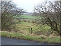

![Lee Lane [the B6428] in S71 3RR](https://images.propbar.co.uk/images/geograph/22/63/2263698_120.jpg)


Area Information
Your move to S71 3RR places you within a compact residential cluster in Yorkshire, covering just 19.2 hectares. This small footprint supports a population of 1,451 residents, creating a neighbourhood where people know each other. You are moving into a space defined by its density rather than sprawling suburban development. The area houses 579 people per square kilometre, meaning streets are lively but not overcrowded. Life here revolves around a close-knit community atmosphere where daily routines intersect with local amenities nearby. Because the area is so defined, you will find everything you need is within a short drive or walk of your new home. This postcode serves as a distinct pocket of living that balances suburban quiet with the convenience of urban access. You do not need to travel far to reach shops, train stations, or schools. The neighbourhood feels secure and established, offering a clear sense of place for those who value a specific slice of the local landscape. Living in S71 3RR means embracing a lifestyle where distance is minimal and community presence is high.
- Area Type
- Postcode
- Area Size
- 19.2 hectares
- Population
- 1451
- Population Density
- 579 people/km²
The property market in S71 3RR is defined by a significant weight towards owner occupation. With 86% of residents being homeowners, you are unlikely to find a high volume of short-term rentals or speculative private housing. The stock consists primarily of houses, which aligns with the area's total population of 1,451 and its status as a specific residential cluster. This housing pattern suggests a market driven by family needs rather than student or professional tenancy. If you are looking to buy, you will find competition primarily among established residents upgrading their homes or families relocating to the area. The fact that houses predominate over flats means that loft conversions and garden extensions are common updates, whereas modern apartment blocks are rare. Living in S71 3RR offers the stability of a mature stock where property values are influenced by local schools and access to transport links like Barnett Railway Station or nearby shops. The lack of rental pressure often allows for stable neighborhood prices that do not fluctuate dramatically with the wider university or corporate rental markets.
House Prices in S71 3RR
Showing 12 properties
| Address | Type | Beds | Baths | Last Sale Price | Last Sale Date | |
|---|---|---|---|---|---|---|
| 5 Greenfield Gardens, Athersley North, Barnsley, S71 3RR | Semi-detached | 2 | 2 | £157,000 | May 2024 | |
| 3 Greenfield Gardens, Athersley North, Barnsley, S71 3RR | Semi-detached | 2 | 1 | £60,000 | Jun 2023 | |
| 6 Greenfield Gardens, Athersley North, Barnsley, S71 3RR | Semi-detached | 2 | 1 | £110,000 | Apr 2021 | |
| 10 Greenfield Gardens, Athersley North, Barnsley, S71 3RR | house | - | - | £136,000 | Feb 2021 | |
| 7 Greenfield Gardens, Athersley North, Barnsley, S71 3RR | Semi-detached | - | - | £80,000 | Sep 2016 | |
| 1 Greenfield Gardens, Athersley North, Barnsley, S71 3RR | Detached | 3 | - | £90,000 | Dec 2009 | |
| 11 Greenfield Gardens, Athersley North, Barnsley, S71 3RR | Semi-detached | - | - | £87,500 | Feb 2005 | |
| 9 Greenfield Gardens, Athersley North, Barnsley, S71 3RR | Semi-detached | - | - | £19,500 | Apr 1998 | |
| 2 Greenfield Gardens, Athersley North, Barnsley, S71 3RR | Detached | - | - | £21,250 | Mar 1997 | |
| 12 Greenfield Gardens, Athersley North, Barnsley, S71 3RR | Semi-detached | - | - | £39,500 | Nov 1996 |
Energy Efficiency in S71 3RR
Daily life in S71 3RR centres around practical amenities that are within easy reach. You have five retail options nearby, including Lidl Wakefield, Co-op Mapplewell, and Co-op New. These shops provide essential grocery needs and daily essentials without requiring a long journey. For commuting, there are five railway stations accessible quickly, such as Darton Railway Station, Barnsley Railway Station, and Dodworth Railway Station. This rail access connects you to major hubs in Yorkshire, making travel to work or leisure activities straightforward. The nearby amenities create a convenient lifestyle where staples and commuting are entirely manageable from your doorstep. You do not need to spend hours driving to urban centres for basic goods or transport connections. The layout of S71 3RR supports a independent and self-sufficient routine. Whether you are grabbing milk or catching a train, the available services are positioned to serve the 1,451 residents efficiently.
Amenities
Schools
Families living in S71 3RR have access to two primary schools within the immediate vicinity. Royston Summer Fields Primary School serves as a local educational option for younger children in the catchment. Another key institution is Summerfields Primary Academy, which currently holds a good Ofsted rating. This rating indicates that the academy meets set standards for education and care, providing reassurance for parents considering the area. The presence of two primary schools offers some choice for families, allowing you to consider factors such as travel distance or specific teaching styles. There are no secondary schools listed in the immediate data for this specific cluster, meaning older children may require transport to schools further away. When evaluating homes near S71 3RR, you should factor in the distance to these primary providers rather than assuming all educational needs are met locally. The availability of a school with a good rating suggests a functional and supportive environment for the children growing up in the neighbourhood.
| Rank | School | Type | Entry gender | Ages |
|---|
Explore more schools in this area
Go to Schools tabDemographics
The community in S71 3RR is mature and established. The median age of residents is 47 years, indicating that adults form the core of this population. Most inhabitants fall within the 30 to 64 years age range, suggesting a workforce and family demographic rather than young students or elderly retirees. This age profile often implies a stable, settled neighbourhood where residents have put down roots. Home ownership is exceptionally high at 86%, showing that the majority of people here own their properties outright or with significant equity. This statistic points to a area where families have stayed for the long term rather than renting temporarily. Houses dominate the accommodation types in this cluster, reflecting a preference for ground-floor or single-storey living suitable for larger family units. The predominant ethnic group is White, which contributes to the area's uniform cultural character. As a whole, the demographic data portrays a traditional, owner-occupied community where attachment to the locality is strong.
Household Size
Accommodation Type
Tenure
Ethnic Group
Religion
Household Composition
Age
Household Deprivation
NS-SEC
Explore more demographic insights in this area
Go to Demographics tabPlanning
Planning Constraints
- Flood RiskPremium
- Ramsar Wetland SitesPremium
- Area of Outstanding Natural BeautyPremium
- Protected Nature ReservePremium
- Protected WoodlandPremium