Area Overview for S71 3HG
Photos of S71 3HG
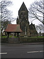
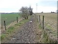
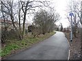
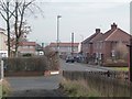

92 photos from this area
Area Information
Key information about the S71 3HG including its size, population, and administrative classification.
- Area Type
- Postcode
- Area Size
- 1.1 hectares
- Population
- 1391
- Population Density
- 1650 people/km²
House Prices in S71 3HG
18
Properties
£164,541
Average Sold Price
£68,000
Lowest Price
£240,000
Highest Price
Showing 18 properties
| Address | Type | Beds | Baths | Last Sale Price | Last Sale Date | |
|---|---|---|---|---|---|---|
| 29 Shaw Lane, Carlton, Barnsley, S71 3HG | Detached | 4 | 3 | £240,000 | Sep 2025 | |
| 55 Shaw Lane, Carlton, Barnsley, S71 3HG | house | - | - | £86,000 | May 2022 | |
| 27 Shaw Lane, Carlton, Barnsley, S71 3HG | Detached | 3 | 2 | £200,000 | Oct 2021 | |
| 33 Shaw Lane, Carlton, Barnsley, S71 3HG | Detached | 4 | - | £215,000 | Apr 2021 | |
| 2A Shaw Lane, Carlton, Barnsley, S71 3HG | house | - | - | £172,000 | Mar 2021 | |
| 31 Shaw Lane, Carlton, Barnsley, S71 3HG | Detached | 4 | 3 | £215,000 | Dec 2020 | |
| 35 Shaw Lane, Carlton, Barnsley, S71 3HG | Detached | - | - | £235,000 | Dec 2019 | |
| 59 Shaw Lane, Carlton, Barnsley, S71 3HG | Detached | 4 | 2 | £144,950 | May 2015 | |
| 53 Shaw Lane, Carlton, Barnsley, S71 3HG | house | - | - | £68,000 | Jul 2013 | |
| 57 Shaw Lane, Carlton, Barnsley, S71 3HG | Land | - | - | £149,000 | Mar 2012 |
Page 1 of 2
Energy Efficiency in S71 3HG
Amenities
Schools
| Rank | School | Type | Entry gender | Ages |
|---|
Explore more schools in this area
Go to Schools tabDemographics
Household Size
Two person
most common
Accommodation Type
Houses
most common
Tenure
77
majority
Ethnic Group
White
most common
Religion
N/A
most common
Household Composition
N/A
most common
Age
47
median
Adults (30-64 years)
most common
Household Deprivation
N/A
with no deprivation
NS-SEC
27
in Lower managerial occupations
Explore more demographic insights in this area
Go to Demographics tabPlanning
Planning Constraints
- Flood RiskPremium
- Ramsar Wetland SitesPremium
- Area of Outstanding Natural BeautyPremium
- Protected Nature ReservePremium
- Protected WoodlandPremium