Area Overview for S71 3EP
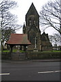
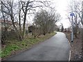
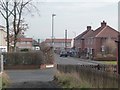
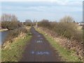
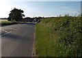
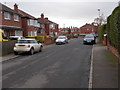
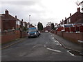
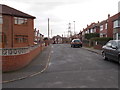
Photos of S71 3EP


Area Information
Living in S71 3EP means residing in a tightly knit residential cluster located within England. The area covers 8388 square metres and houses a population of 1391 residents. You will find a particularly dense community here, with a population density of 165,838 people per square kilometre. This concentration creates a neighbourhood where neighbours are invariably known by name. Daily life revolves around the immediate surroundings of this small postcode sector. The environment is defined by its close proximity rather than wide expanses of green space. You are part of a residential pocket where the local character is shaped by the high density of homes in this specific cluster. The setting offers a distinct experience of urban living on a smaller scale. Residents here navigate a landscape that prioritises proximity to essential services over vast open areas. The high density means that infrastructure is generally within short walking distances for most households. However, the compact nature of the location also means that you must be accustomed to living in close quarters. The area serves as a functional residential hub for families and individuals who value convenience. It is not a sprawling suburb but a concentrated patch of housing where community interactions happen frequently due to the sheer number of people living in such a small footprint.
- Area Type
- Postcode
- Area Size
- 8388 m²
- Population
- 1391
- Population Density
- 1650 people/km²
The property market in S71 3EP is overwhelmingly geared towards owner-occupied housing. With 77% of households classified as owner-occupiers, the area functions less as a rental market and more as an established residential zone. Buyers looking at this postcode should expect to find a marketplace where existing homeowners list properties for sale rather than landlords seeking tenants. The accommodation type data confirms that houses dominate the stock, meaning you will encounter single-family detached or semi-detached properties rather than apartments or high-rise flats. This concentration of houses and high ownership levels suggests a market where price stability depends on local neighbourhood dynamics rather than wider rental fluctuations. If you are buying homes in S71 3EP, the inventory will reflect a traditional residential stock. The area attracts those seeking to settle permanently, which often drives demand in the second-hand market. You should prepare for a buying environment where sellers have typically lived in the property for several years. The lack of rental stock in the data implies that the supply is almost entirely dedicated to residents who intend to remain in the area long-term. This makes the area suitable for buyers with bigger budgets rather than first-time buyers relying heavily on the private rental sector.
House Prices in S71 3EP
Showing 3 properties
| Address | Type | Beds | Baths | Last Sale Price | Last Sale Date | |
|---|---|---|---|---|---|---|
| 32 Royston Lane, Carlton, Barnsley, S71 3EP | Bungalow | - | - | £220,000 | Apr 2007 | |
| 36 Royston Lane, Carlton, Barnsley, S71 3EP | Detached | - | - | £86,000 | Feb 1998 | |
| 34 Royston Lane, Carlton, Barnsley, S71 3EP | Detached | - | - | - | - |
Energy Efficiency in S71 3EP
Your daily lifestyle in S71 3EP centres on convenient access to essential retail and transport hubs. Within practical reach are five retail outlets, including Co-op Barnsley, Spar Royston, and Co-op Royston. These venues provide convenient access to groceries and everyday necessities without the need to travel far. For commuters, the area benefits from five railway stations within easy access. Notable stations include Barnsley Railway Station, Darton Railway Station, and Fitzwilliam Railway Station. These transport links facilitate easy travel to wider employment centres and other parts of the region. The convenience of these amenities means you do not have to venture far for basic needs. Shopping trips at the Co-op locations can be completed quickly, saving time during busy days. The availability of multiple railway stations offers flexibility, allowing you to choose the most convenient line for your destination. This mix of local retail and major transport nodes creates a functional environment where daily life runs smoothly. The area supports a routine where work, shopping, and travel are efficiently managed. Residents benefit from a location that balances local independence with the connectivity required for a broader regional lifestyle.
Amenities
Schools
Families living in S71 3EP have access to a dedicated network of educational institutions locally. The nearest primary education includes Carlton Primary School and Carlton Community College, alongside Carlton Primary Academy. Regarding the latter, the available data confirms it holds a 'good' Ofsted rating, providing a solid educational option for younger children. For secondary education, Outwood Academy Carlton serves as the local academy. This institution also carries a 'good' Ofsted rating, ensuring that older students have access to a well-regarded academic environment. The mix of school types offers flexibility for residents with different needs. The presence of academies indicates a modern educational structure integrated into the local system. The fact that multiple nearby schools share a similar rating suggests a generally high standard of education across the immediate catchment area. Parents considering moving to S71 3EP will find that the area is supported by a cluster of schools that meet quality standards. This concentration reduces the need for long commutes to education, keeping children closer to home. The availability of both primary and secondary options within reachable distance is a significant advantage for families evaluating this postcode.
| Rank | School | Type | Entry gender | Ages |
|---|
Explore more schools in this area
Go to Schools tabDemographics
The community character of S71 3EP is defined by a mature population. The median age in the area is 47 years, reflecting a resident base centred on adults aged between 30 and 64 years. You will find that most households are headed by individuals in their middle years rather than young families or retired seniors living alone. This demographic profile suggests an area established by those who have already navigated the early stages of family life and career building. Home ownership stands as a dominant feature of this neighbourhood, with 77% of residents owning their homes outright or with a mortgage. This high percentage indicates a stable community where long-term settlement is the norm rather than transient renting. The accommodation type throughout S71 3EP consists primarily of houses, which aligns with the prevalence of owner-occupier households. While the predominant ethnic group is White, the specific diversity metrics provided confirm the primary cultural composition of the residents you might meet at the local shops. The combination of a high median age and strong home ownership rates paints a picture of a settled,根深蒂固 community focused on stability and local investment.
Household Size
Accommodation Type
Tenure
Ethnic Group
Religion
Household Composition
Age
Household Deprivation
NS-SEC
Explore more demographic insights in this area
Go to Demographics tabPlanning
Planning Constraints
- Flood RiskPremium
- Ramsar Wetland SitesPremium
- Area of Outstanding Natural BeautyPremium
- Protected Nature ReservePremium
- Protected WoodlandPremium