Area Overview for S71 3EE
Photos of S71 3EE
Area Information
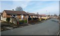
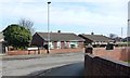
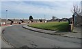
S71 3EE represents a tightly packed residential cluster covering only 1.1 hectares, yet it supports a population of 1,630 people. This high population density of 150,001 people per square kilometre creates an environment where neighbours are frequently within sight, defining a very specific type of urban living. You are entering an area characterised by large numbers of residents living in close quarters, which fundamentally shapes the community dynamic. The postcode is situated in England and functions as a distinct node within the broader housing market. Living in S71 3EE means navigating a space where housing demand is immense relative to the available land. The sheer concentration of 1,630 individuals on such a small footprint suggests an area where space efficiency is paramount. This setting appeals to those who value proximity above all else, though the lack of larger open spaces is an inherent characteristic of the site. Your daily journey here will be defined by the immediate density, requiring careful consideration of noise and privacy. The area serves as a residential hub for a significant demographic, making it a key location for understanding local housing trends. The distinctiveness of S71 3EE lies in this intense packing of residents into a compact footprint. You will find yourself part of a community where individual plots are rare, and shared infrastructure carries a heavier load. This overview sets the stage for deeper analysis of who actually resides in these homes and how they utilise the limited resources available to them. It is a place for those who accept high density as a trade-off for location utility.
- Area Type
- Postcode
- Area Size
- 1.1 hectares
- Population
- 1630
- Population Density
- 3816 people/km²
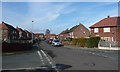
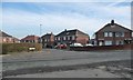
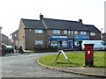
The property market in S71 3EE is defined by a specific accommodation type profile and clear tenure patterns. Every property listed under this postcode falls into the category of Houses, establishing a consistent housing stock for buyers to consider. This uniformity simplifies your search process compared to mixed-use zones containing flats and apartments. However, the sheer volume of residents combined with the small land area of 1.1 hectares implies a housing market where supply is strictly limited by geography. Ownership sits at 36%, meaning you are statistically more likely to purchase from a private landlord or buy into a market where rental competition exists. This level of home ownership indicates that the area is not exclusively an estate for buy-to-let investors, nor is it a traditional family home zone where ownership dominates. Instead, you will find a blend of private owners and residents paying rent, which creates a versatile but competitive market. When looking at homes in S71 3EE, you must understand that the physical footprint restricts new developments, keeping prices dependent on the existing stock. The 150,001 people per square kilometre density means that even single houses are situated very close together, which can impact property values and privacy. Buyers seeking traditional suburban separation may find the conditions here challenging without further research into specific street layouts. Yet, the dedication to a house-based accommodation type suggests that the housing stock is built for individual family units rather than shared communal flats. Your decision to buy here weighs heavily on the trade-off between the density and the availability of standalone house units within the postcodes.
House Prices in S71 3EE
Showing 26 properties
| Address | Type | Beds | Baths | Last Sale Price | Last Sale Date | |
|---|---|---|---|---|---|---|
| 27 Clipstone Avenue, Athersley North, Barnsley, S71 3EE | Semi-detached | 3 | 1 | - | - | |
| 29 Clipstone Avenue, Athersley North, Barnsley, S71 3EE | house | - | - | - | - | |
| 20 Clipstone Avenue, Athersley North, Barnsley, S71 3EE | house | - | - | - | - | |
| 16 Clipstone Avenue, Athersley North, Barnsley, S71 3EE | house | - | - | - | - | |
| 24 Clipstone Avenue, Athersley North, Barnsley, S71 3EE | house | - | - | - | - | |
| 17 Clipstone Avenue, Athersley North, Barnsley, S71 3EE | house | - | - | - | - | |
| 47 Clipstone Avenue, Athersley North, Barnsley, S71 3EE | house | - | - | - | - | |
| 37 Clipstone Avenue, Athersley North, Barnsley, S71 3EE | house | - | - | - | - | |
| 14 Clipstone Avenue, Athersley North, Barnsley, S71 3EE | Semi-detached | - | - | - | - | |
| 13 Clipstone Avenue, Athersley North, Barnsley, S71 3EE | house | - | - | - | - |
Energy Efficiency in S71 3EE
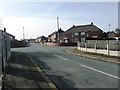
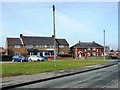
Daily life in S71 3EE is underpinned by accessible retail and transport infrastructure within a short walking distance. You have five retail stores nearby, including Co-op New, Lidl Wakefield, and Farmfoods Athersley. These supermarkets provide essential groceries and daily necessities, ensuring you can manage your household budget without needing long journeys. The proximity of these outlets is a tangible benefit for those living in the dense residential cluster, supporting family routines and quick errands. Commuters and socialites alike benefit from five railway stations within reach, specifically Barnsley Railway Station, Darton Railway Station, and Dodworth Railway Station. These transport hubs offer easy access to wider networks, meaning your lifestyle is not trapped in the immediate local vicinity. You can reach broader cultural centres or business districts with minimal fuss, which adds a layer of versatility to your weekly schedule. The combination of immediate retail needs and broader transport links creates a balanced convenience for residents. The 150,001 people per square kilometre density ensures that these amenities are never far away, which is crucial for time-poor households. You do not need a car to enjoy the local economy or commute to work, as the nearest options are right on your doorstep. The presence of major chains like Lidl and Co-op signals that the local high streets are designed to serve a high-volume customer base efficiently. This network of services supports the needs of the 1,630 residents who call this area home.
Amenities
Schools
| Rank | School | Type | Entry gender | Ages |
|---|
Explore more schools in this area
Go to Schools tabDemographics
The demographic profile of S71 3EE is dominated by adults, with a median age of 47. The most common age range consists of residents between 30 and 64 years old, indicating a workforce-oriented community rather than one primarily composed of retirees or young families. Out of the total population of 1,630, you will encounter a community primarily available in working or pre-retirement life stages. This profile suggests a neighbourhood where stability and established careers are common themes. Housing tenure in S71 3EE shows a split approach, with 36% of households reporting owner-occupancy. This leaves the majority of the population residing in rented accommodation, which significantly influences the social fabric of the area. This high rental rate often correlates with a transient population compared to areas with higher ownership figures. You should anticipate a mix of long-term tenants and landlords managing properties within the 1.1-hectare boundary. The population density of 150,001 people per square kilometre reinforces the intensity of this shared living environment. Ethnically, the area is predominantly White, reflecting the broader regional patterns found across South Yorkshire. There is no data provided on further granular diversity metrics, but the primary composition remains consistent with national averages for the region. The accommodation type is recorded as Houses, which is notable given the extreme density; you might expect these structures to be tightly packed terraced properties or converted units within the postcode. These factors combine to create a specific socio-economic landscape where adult professionals and families coexist in high volumes.
Household Size
Accommodation Type
Tenure
Ethnic Group
Religion
Household Composition
Age
Household Deprivation
NS-SEC
Explore more demographic insights in this area
Go to Demographics tabPlanning
Planning Constraints
- Flood RiskPremium
- Ramsar Wetland SitesPremium
- Area of Outstanding Natural BeautyPremium
- Protected Nature ReservePremium
- Protected WoodlandPremium