Area Overview for S71 3DP
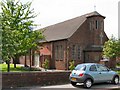
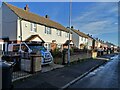
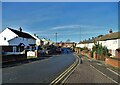
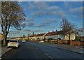
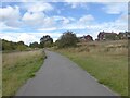
Photos of S71 3DP
Area Information
The postcode S71 3DP defines a compact residential cluster covering just 1.5 hectares. Despite its small physical footprint, the area supports a population of 1,630 people. This results in a population density of 110,362 people per square kilometre, which indicates very closely packed living conditions. You will find yourself in a location designed primarily for housing rather than as a mixed-use district. The high density suggests an environment where neighbours are likely to be within immediate sight and hearing range. Life here revolves around proximity, with residents relying on local infrastructure for their daily needs. The area functions as a self-contained pocket of the wider Wakefield district. Buyers considering homes in S71 3DP must accept the reality of intense localisation. The limited land area means there is little room for expansion or significant redevelopment. Every property sits within a tightly defined boundary, creating a unique sense of community defined by spatial constraints rather than open green spaces.
- Area Type
- Postcode
- Area Size
- 1.5 hectares
- Population
- 1630
- Population Density
- 3816 people/km²
Homes in S71 3DP are characterised by a specific housing stock dominated by houses rather than apartments. This architectural preference aligns with the area's low-rise character and residential zoning. With home ownership standing at 36%, the market presents a mixed terrain of owner-occupiers and landlords. While the majority of properties are houses, the sub-40% ownership rate signals a healthy level of private renting or partnerships. This structure may appeal to those seeking a home where immediate neighbours have established roots. The small physical size of the area limits the volume of available stock, meaning demand could outstrip supply for suitable houses. Buyers looking at this cluster should note that every property benefits from the specific constraints of the 1.5-hectare site. The lack of multi-unit blocks suggests a quieter, more suburban lifestyle compared to high-density city centres. The market dynamics here favour those comfortable with smaller, village-like neighbourhoods.
House Prices in S71 3DP
Showing 27 properties
| Address | Type | Beds | Baths | Last Sale Price | Last Sale Date | |
|---|---|---|---|---|---|---|
| 84 Ollerton Road, Athersley North, Barnsley, S71 3DP | house | - | - | £160,000 | Jun 2025 | |
| 119 Ollerton Road, Athersley North, Barnsley, S71 3DP | house | 3 | 1 | £95,000 | May 2022 | |
| 72 Ollerton Road, Athersley North, Barnsley, S71 3DP | house | - | - | £93,000 | Oct 2021 | |
| 107 Ollerton Road, Athersley North, Barnsley, S71 3DP | Semi-detached | 2 | - | £70,000 | Oct 2020 | |
| 96 Ollerton Road, Athersley North, Barnsley, S71 3DP | Semi-detached | 3 | - | £85,000 | Nov 2019 | |
| 115 Ollerton Road, Athersley North, Barnsley, S71 3DP | Semi-detached | 3 | - | £74,000 | Dec 2017 | |
| 125 Ollerton Road, Athersley North, Barnsley, S71 3DP | Semi-detached | 4 | - | £95,000 | Apr 2015 | |
| 105 Ollerton Road, Athersley North, Barnsley, S71 3DP | Semi-detached | - | - | £50,000 | Jun 2014 | |
| 123 Ollerton Road, Athersley North, Barnsley, S71 3DP | Semi-detached | - | - | £81,000 | Dec 2007 | |
| 80 Ollerton Road, Athersley North, Barnsley, S71 3DP | house | - | - | £82,000 | Jul 2006 |
Energy Efficiency in S71 3DP
Daily life in S71 3DP offers straightforward access to essential retail and transport hubs nearby. Within practical reach, you have five retail outlets and five railway stations serving the broader community. Notable shopping destinations include Co-op New, Lidl Wakefield, and Farmfoods Athersley, providing comprehensive options for food and general goods. These supermarkets ensure that grocery shopping is a convenient part of your weekly routine. For travel, you can access Barnsley Railway Station, Darton Railway Station, and Dodworth Railway Station, giving you multiple rail links for commuting. These stations facilitate easy connections to wider job markets in South Yorkshire. The proximity of these amenities reduces the need for long journeys for basic services. You can rely on local supermarkets for daily essentials rather than travelling into town centres. This setup supports a practical, car-adjacent lifestyle where major shopping and transport nodes are a short drive away.
Amenities
Schools
| Rank | School | Type | Entry gender | Ages |
|---|
Explore more schools in this area
Go to Schools tabDemographics
The community in S71 3DP is defined by a mature demographic profile. The median age stands at 47 years, and adults aged between 30 and 64 years represent the most common age range in the district. This indicates a neighbourhood dominated by families and established professionals rather than young students or retirees living alone. Home ownership figures show that 36% of residents own their property outright or with a mortgage. Consequently, a significant portion of the 1,630 local population consists of private renters or those living in family homes rather than bachelor flats. The prevailing accommodation type is houses, suggesting a preference for detached or semi-detached structures over urban flats. The population is predominantly White, reflecting a relatively homogenous local ethnic makeup. These statistics paint a picture of a stable, middle-aged community where long-term residence appears common. The housing stock caters specifically to household sizes larger than one person, given the data on age and accommodation types.
Household Size
Accommodation Type
Tenure
Ethnic Group
Religion
Household Composition
Age
Household Deprivation
NS-SEC
Explore more demographic insights in this area
Go to Demographics tabPlanning
Planning Constraints
- Flood RiskPremium
- Ramsar Wetland SitesPremium
- Area of Outstanding Natural BeautyPremium
- Protected Nature ReservePremium
- Protected WoodlandPremium