Area Overview for S71 2AR
Photos of S71 2AR


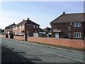
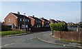
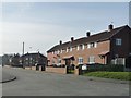
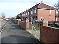
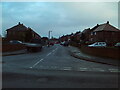
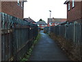
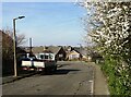
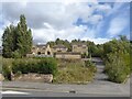

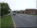
15 photos from this area
Area Information
Key information about the S71 2AR including its size, population, and administrative classification.
- Area Type
- Postcode
- Area Size
- 4.0 hectares
- Population
- 1489
- Population Density
- 4290 people/km²
House Prices in S71 2AR
80
Properties
£78,627
Average Sold Price
£35,000
Lowest Price
£125,000
Highest Price
Showing 80 properties
| Address | Type | Beds | Baths | Last Sale Price | Last Sale Date | |
|---|---|---|---|---|---|---|
| 14 Belmont Avenue, Smithies, Barnsley, S71 2AR | house | - | - | £110,000 | Apr 2025 | |
| 87 Belmont Avenue, Smithies, Barnsley, S71 2AR | Flat | - | - | £85,000 | Feb 2023 | |
| 27 Belmont Avenue, Smithies, Barnsley, S71 2AR | Retail | 2 | 1 | £82,000 | Jun 2022 | |
| 15 Belmont Avenue, Smithies, Barnsley, S71 2AR | Semi-detached | 3 | 2 | £125,000 | Nov 2019 | |
| 8 Belmont Avenue, Smithies, Barnsley, S71 2AR | Semi-detached | 3 | 1 | £72,500 | Apr 2019 | |
| 4 Belmont Avenue, Smithies, Barnsley, S71 2AR | house | - | - | £65,000 | Jan 2019 | |
| 55 Belmont Avenue, Smithies, Barnsley, S71 2AR | Flat | - | - | £55,000 | Dec 2018 | |
| 12 Belmont Avenue, Smithies, Barnsley, S71 2AR | Semi-detached | 4 | 2 | £112,500 | May 2018 | |
| 91 Belmont Avenue, Smithies, Barnsley, S71 2AR | Maisonette | 2 | - | £60,000 | May 2018 | |
| 16 Belmont Avenue, Smithies, Barnsley, S71 2AR | Semi-detached | 3 | - | £110,000 | Aug 2016 |
Page 1 of 8
Energy Efficiency in S71 2AR
Amenities
Schools
| Rank | School | Type | Entry gender | Ages |
|---|
Explore more schools in this area
Go to Schools tabDemographics
Household Size
Family (3-5 people)
most common
Accommodation Type
Houses
most common
Tenure
67
majority
Ethnic Group
White
most common
Religion
N/A
most common
Household Composition
N/A
most common
Age
47
median
Adults (30-64 years)
most common
Household Deprivation
N/A
with no deprivation
NS-SEC
22
in Lower managerial occupations
Explore more demographic insights in this area
Go to Demographics tabPlanning
Planning Constraints
- Flood RiskPremium
- Ramsar Wetland SitesPremium
- Area of Outstanding Natural BeautyPremium
- Protected Nature ReservePremium
- Protected WoodlandPremium