Area Overview for S70 6NH
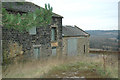
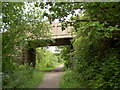
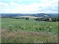
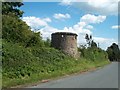
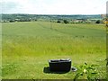
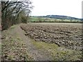
Photos of S70 6NH


Area Information
S70 6NH is a specific postcode area covering a small residential cluster in England, defined by its size of just 20.8 hectares. This compact footprint creates a tightly knit environment where the 1,507 residents have direct access to their immediate surroundings. Living in S70 6NH means experiencing a neighbourhood where, on average, 1,286 people live per square kilometre. The area functions as a quiet residential enclave rather than a bustling town centre, yet it maintains crucial links to larger infrastructure hubs like Barnsley. You can expect daily life here to be characterised by proximity to essential services without the intense density of a major urban centre. The layout supports a lifestyle where a short drive connects you to major railway stations and supermarkets, while the local streets offer a quieter retreat. Residents benefit from a manageable community scale that simplifies navigation and fosters a sense of locality.
- Area Type
- Postcode
- Area Size
- 20.8 hectares
- Population
- 1507
- Population Density
- 1286 people/km²
The housing market in S70 6NH is distinctly characterised by owner-occupancy, driven by the fact that 66 percent of residents own their homes. This suggests a market where equity is held rather than rented, creating a stable environment for buyers looking to join the community. The predominant accommodation type is houses, meaning you will find detached and semi-detached properties rather than apartments or flats. This stock appeals to those seeking traditional British housing forms with private gardens and communal spaces. Living in S70 6NH offers the security of an established market where property values tend to reflect long-term holding rather than rapid turnover. For buyers, this implies fewer short-term rental fluctuations and a pool of properties that cater to families and professionals requiring space. The local housing landscape supports a permanent lifestyle, where every home serves as a long-term asset for its current owner.
House Prices in S70 6NH
Showing 13 properties
| Address | Type | Beds | Baths | Last Sale Price | Last Sale Date | |
|---|---|---|---|---|---|---|
| Lancaster House, Keresforth Hall Drive, Kingstone, Barnsley, S70 6NH | house | 3 | 1 | £315,000 | Apr 2024 | |
| Keresforth Hall, Keresforth Hall Drive, Kingstone, Barnsley, S70 6NH | Detached | 3 | - | £867,500 | Jan 2023 | |
| Broad Acres, Keresforth Hall Drive, Kingstone, Barnsley, S70 6NH | house | - | - | £675,000 | Jun 2021 | |
| Camelia House, Keresforth Hall Drive, Kingstone, Barnsley, S70 6NH | Detached | - | - | £525,000 | Mar 2011 | |
| Brodie House, Keresforth Hall Drive, Kingstone, Barnsley, S70 6NH | Detached | 3 | 3 | £450,000 | Feb 2011 | |
| The Farm Cottage, Keresforth Hall Drive, Kingstone, Barnsley, S70 6NH | house | - | - | £162,625 | Jun 2006 | |
| The Old Barn, Keresforth Hall Drive, Kingstone, Barnsley, S70 6NH | Retail | 3 | 2 | - | - | |
| 2, The Coach House, Keresforth Hall Drive, Kingstone, Barnsley, S70 6NH | house | 3 | - | - | - | |
| 3, The Coach House, Keresforth Hall Drive, Kingstone, Barnsley, S70 6NH | Terraced | 3 | 1 | - | - | |
| Pinehills, Keresforth Hall Drive, Kingstone, Barnsley, S70 6NH | Detached | - | - | - | - |
Energy Efficiency in S70 6NH
Residents of S70 6NH enjoy convenient access to retail and transport hubs without needing to travel deep into the city for daily needs. Within practical reach are five retail supermarkets, including Co-op Kingstone, Morrisons Barnsley, and Lidl Central. These venues provide ample choice for weekly shopping, from fresh groceries to household essentials. For commuting, the area is served by five rail stations, with Barnsley Railway Station, Dodworth Railway Station, and Silkstone Common Railway Station as notable options. This transport density means you can work in Barnsley or beyond without relying solely on a car. The layout of amenities suggests a lifestyle where daily errands are quick and efficient. You can access essential services, dining options, and leisure activities that are located near the cluster, supporting a balanced routine that combines local convenience with regional connectivity.
Amenities
Schools
Families considering schools near S70 6NH will find Rockley Mount School as the key educational facility listed for the area. This institution operates as a special school, providing education tailored to specific needs rather than the mainstream comprehensive model. The presence of a special school indicates that the local education infrastructure caters to diverse requirements, offering specialised support within the vicinity of homes in S70 6NH. While this may not offer the full range of primary and secondary options found in larger towns, it provides targeted educational resources for those with specific requirements. Choosing to live here means your children may access specialised care closer to home compared to urban centres where such facilities are often further away. The school type defines the educational ethos of the immediate neighbourhood, focusing on individualised learning paths rather than standardised curriculum delivery.
| Rank | School | Type | Entry gender | Ages |
|---|
Explore more schools in this area
Go to Schools tabDemographics
The community profile in S70 6NH reflects a mature population, with a median age of 47 years. Most commonly, the area is populated by adults between 30 and 64 years old, suggesting a stable household dynamic. Over 66 percent of households own their homes, indicating a strong tradition of long-term residence within this postcode area. This high ownership rate contrasts with the national average and points to a community settled in for the long term rather than a transient renting market. The vast majority of the housing stock consists of houses, aligning with the demographic profile of families or individuals seeking permanence. Predominantly, the ethnic group making up the population is White, reflecting the broader social composition of much of South Yorkshire. This demographic stability contributes to a predictable community environment where residents are established and likely invested in the local improvement of S70 6NH.
Household Size
Accommodation Type
Tenure
Ethnic Group
Religion
Household Composition
Age
Household Deprivation
NS-SEC
Explore more demographic insights in this area
Go to Demographics tabPlanning
Planning Constraints
- Flood RiskPremium
- Ramsar Wetland SitesPremium
- Area of Outstanding Natural BeautyPremium
- Protected Nature ReservePremium
- Protected WoodlandPremium