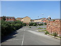
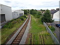
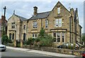
Area Overview for S70 6BY
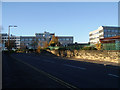
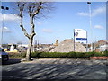
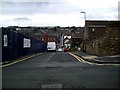
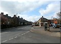
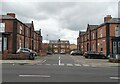
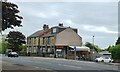
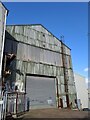
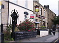
Photos of S70 6BY
Area Information
S70 6BY represents a compact residential cluster in Barnsley with a total footprint of just 4,183 square metres. Despite its small physical size, the postcode accommodates a specific population of 2,254 residents. You are considering a home in S70 6BY where daily life revolves around a dense concentration of people within a defined boundary. The area functions as a tight-knit pocket of the wider locality, designed primarily for housing rather than commercial sprawl. Prospective buyers seeking homes in S70 6BY find a space that prioritises density over extensive green corridors or large-scale infrastructure within the immediate perimeter. The character of the neighbourhood is shaped by this high population density, creating an environment where community interaction happens closer to the door. This specific postcode serves as a gateway to the broader town facilities while maintaining a distinct residential identity. Understanding the scale of S70 6BY helps you manage expectations; it is not a sprawling suburb but a contained settlement with direct access to essential services situated nearby.
- Area Type
- Postcode
- Area Size
- 4183 m²
- Population
- 2254
- Population Density
- 9804 people/km²
House Prices in S70 6BY
Showing 15 properties
| Address | Type | Beds | Baths | Last Sale Price | Last Sale Date | |
|---|---|---|---|---|---|---|
| 10 Stanley Street, Barnsley, S70 6BY | Terraced | 4 | 1 | £82,000 | Jul 2023 | |
| 5 Stanley Street, Barnsley, S70 6BY | Terraced | 3 | 1 | £85,000 | Oct 2021 | |
| 14 Stanley Street, Barnsley, S70 6BY | Terraced | 2 | - | £66,500 | May 2021 | |
| 8 Stanley Street, Barnsley, S70 6BY | Terraced | 3 | - | £78,000 | Oct 2020 | |
| 22 Stanley Street, Barnsley, S70 6BY | house | 2 | - | £60,000 | Oct 2017 | |
| 20 Stanley Street, Barnsley, S70 6BY | Terraced | 2 | 1 | £61,920 | Nov 2015 | |
| 3 Stanley Street, Barnsley, S70 6BY | Terraced | 3 | 1 | £55,000 | Jul 2008 | |
| 2 Stanley Street, Barnsley, S70 6BY | Terraced | 2 | - | £65,000 | Jun 2008 | |
| 12 Stanley Street, Barnsley, S70 6BY | house | 3 | 1 | £63,000 | Aug 2005 | |
| 4 Stanley Street, Barnsley, S70 6BY | Terraced | 3 | - | £59,000 | May 2004 |
Energy Efficiency in S70 6BY
Amenities
Schools
| Rank | School | Type | Entry gender | Ages |
|---|
Explore more schools in this area
Go to Schools tabDemographics
The community residing in S70 6BY reflects a成熟 (mature) demographic profile with a median age of 47 years. The majority of residents fall within the adult age range of 30 to 64 years, suggesting a household base that typically includes established families, couples raising children, and empty nesters. You will find that 27 per cent of the population owns their home outright, meaning the remaining 73 per cent likely resides in rented accommodation or through other tenure arrangements. Houses form the predominant type of accommodation within this specific postcode, offering stand-alone structures rather than high-rise living. The ethnic composition is predominantly White, aligning with the broader local context. Because the area contains only houses and lacks family emphasis in the provided data, you should consider whether the built environment meets your specific household needs. The age distribution indicates a stable community less reliant on students or young professionals, which may influence local business hours and social activities. This steady demographic profile offers a consistent living environment for those accustomed to established neighbourhoods.
Household Size
Accommodation Type
Tenure
Ethnic Group
Religion
Household Composition
Age
Household Deprivation
NS-SEC
Explore more demographic insights in this area
Go to Demographics tabPlanning
Planning Constraints
- Flood RiskPremium
- Ramsar Wetland SitesPremium
- Area of Outstanding Natural BeautyPremium
- Protected Nature ReservePremium
- Protected WoodlandPremium