Area Overview for S70 5YX
Photos of S70 5YX


Area Information
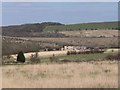
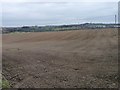
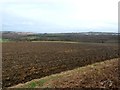
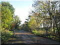
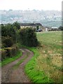
Living in S70 5YX offers a snapshot of quiet residential life within the distinctive postal framework of South Yorkshire. This specific postcode covers a small residential cluster characterised by stable demographics and a strong sense of local settlement. With a population of 1,635 residents, the area maintains a manageable density, averaging approximately 475 people per square kilometre. Such a compact footprint suggests a neighbourhood where residents know one another and where the pace of daily life moves at a deliberate, unhurried rhythm. The environment is defined by its exclusivity as a residential zone rather than a commercial hub, ensuring that domestic tranquillity remains the primary focus of the streetscape. Prospective homebuyers looking for homes in S70 5YX will find an environment tailored to established families and long-term residents. The area's small scale means that major urban centres like Barnsley or Rotherham sit just beyond the immediate horizon, yet local amenities remain within practical reach. The community feels cohesive, grounded by a history of occupancy that spans decades. You can expect a setting where the boundaries between public and private space are clearly defined, fostering a secure atmosphere for raising a family. The distinct character of this postcode ensures that every street corner carries a specific identity, free from the transient nature of larger urban developments.
- Area Type
- Postcode
- Area Size
- Not available
- Population
- 1635
- Population Density
- 475 people/km²
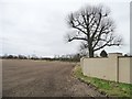
The housing market in S70 5YX is defined by a strong preference for traditional family homes and a clear dominance of owner-occupied properties. With 79% of households reporting home ownership, this area functions primarily as a buyer's market rather than a rental hub. This statistic suggests that many residents have purchased their current homes and have extended their tenure over time, creating a stock of properties that have been cared for by long-term occupants. The accommodation type is strictly houses, meaning you will not find flats or maisonettes in this particular cluster. This specification appeals specifically to families with children or those seeking private outdoor spaces. For anyone looking at homes in S70 5YX, the opportunity to buy often involves engaging directly with local sellers rather than competing in a high-volume lettings market. The sheer number of properties available for sale will be limited by the small population base of 1,635, meaning inventory is scarce and likely to move quickly if priced correctly. There are no apartment buildings or shared-ownership schemes formally recorded for this postcode, which simplifies the transaction process but requires early decision-making. If you are seeking a property in this area, expect to deal with standard detached or semi-detached stock rather than speculative new builds or converted units. The market reflects the needs of a settled population, valuing established character over modern conversions.
House Prices in S70 5YX
No properties found in this postcode.
Energy Efficiency in S70 5YX
Daily life in S70 5YX revolves around practical convenience and proximity to essential retail and transport hubs. Within a short driving distance, you have access to a selection of supermarkets including Morrisons Daily Birdwell, Asda Worsbrough, and Morrisons Daily Barnsley 73. These venues ensure that all your grocery shopping and household essentials are available without needing to travel far. For public transport, the area is well-placed relative to major railway stations. You can access Barnsley Railway Station, Wombwell Railway Station, and Elsecar Railway Station for regional and national connectivity. This arrangement means you do not need a car for every outing, yet you have the flexibility of personal transport when required. The presence of five notable retail outlets and five train station options illustrates a balance between a quiet residential setting and easy access to the wider region. You can run local errands at Morrisons Daily Birdwell in the morning and commute from the postcode via Elsecar Railway Station later in the day. Amenities are few in number but highly relevant to daily household management. The lifestyle here is defined by efficiency, allowing you to manage family needs from a compact, well-serviced location.
Amenities
Schools
Families residing in S70 5YX have access to limited but adequate educational provision within their immediate vicinity. The nearest educational facility is Worsbrough St Mary's CofE Primary School, which serves the local community for younger children. This school provides primary education under the Church of England ethos, offering a structured environment for pupils in the foundational years. While secondary education options are not detailed for this specific postcode, the proximity of this primary institution indicates a catchment area designed for local families. The availability of a single named primary school suggests a focused educational landscape where choices are clear and manageable for parents. Living in S70 5YX means your children will likely first attend Worsbrough St Mary's CofE Primary School before potentially transferring to secondary institutions in wider Barnsley or South Yorkshire. The concentration on one primary option highlights the autonomy of the local education committee to name and manage specific facilities. For those prioritising schooling, the existence of this specific named institution provides a tangible point of reference when making location decisions. While the data does not list secondary schools or Ofsted ratings for them, the presence of a firm primary provider shows a commitment to basic educational infrastructure. You can rely on this school for the early years of your child's development while you research broader secondary options in neighbouring towns.
| Rank | School | Type | Entry gender | Ages |
|---|
Explore more schools in this area
Go to Schools tabDemographics
The community profile in S70 5YX reflects a mature neighbourhood with a significant proportion of established households. The median age of residents stands at 47 years, placing the area firmly within the demographic bracket of older adults. Most commonly, the population consists of adults aged between 30 and 64 years, a range that typically correlates with family formation and career stability. This age distribution contributes to a calm neighbourhood character where noise levels are generally low and interactions with neighbours are predictable and friendly. Home ownership strengthens this sense of permanence, with 79% of properties owned outright or via mortgage. This high rate of ownership indicates a stable community where residents have deep roots and a long-term commitment to their local streets. The area is also predominantly homogeneous in terms of ethnicity, with the White ethnic group forming the majority of the population. While specific deprivation statistics are not listed in the current records, the high home ownership rate and mature age profile often correlate with financial stability among residents. Accommodation types are almost exclusively houses, creating a unified streetscape where garden spaces and private dwellings dominate the landscape. This lack of high-density housing further reinforces the family-oriented nature of the area. You will find a demographic that values stability and community integration over the transient lifestyle found in rental-dominated zones.
Household Size
Accommodation Type
Tenure
Ethnic Group
Religion
Household Composition
Age
Household Deprivation
NS-SEC
Explore more demographic insights in this area
Go to Demographics tabPlanning
Planning Constraints
- Flood RiskPremium
- Ramsar Wetland SitesPremium
- Area of Outstanding Natural BeautyPremium
- Protected Nature ReservePremium
- Protected WoodlandPremium