Area Overview for S70 5XG
Photos of S70 5XG
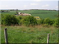
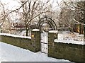
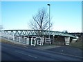
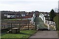


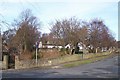
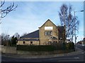
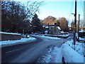
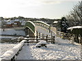
52 photos from this area
Area Information
Key information about the S70 5XG including its size, population, and administrative classification.
- Area Type
- Postcode
- Area Size
- 2.3 hectares
- Population
- 2005
- Population Density
- 862 people/km²
House Prices in S70 5XG
68
Properties
£91,619
Average Sold Price
£38,625
Lowest Price
£112,500
Highest Price
Showing 68 properties
| Address | Type | Beds | Baths | Last Sale Price | Last Sale Date | |
|---|---|---|---|---|---|---|
| 53 Rockingham Close, Birdwell, Barnsley, S70 5XG | Semi-detached | 2 | 1 | £105,000 | Jan 2025 | |
| 61 Rockingham Close, Birdwell, Barnsley, S70 5XG | Semi-detached | 2 | 1 | £97,500 | Aug 2023 | |
| 38 Rockingham Close, Birdwell, Barnsley, S70 5XG | Bungalow | - | - | £108,750 | Mar 2023 | |
| 32 Rockingham Close, Birdwell, Barnsley, S70 5XG | Retail | 1 | 1 | £100,000 | Oct 2022 | |
| 30 Rockingham Close, Birdwell, Barnsley, S70 5XG | Retail | 2 | 1 | £110,000 | Aug 2022 | |
| 63 Rockingham Close, Birdwell, Barnsley, S70 5XG | Bungalow | - | - | £71,250 | Dec 2021 | |
| 42 Rockingham Close, Birdwell, Barnsley, S70 5XG | Semi-detached | 2 | - | £95,625 | Nov 2021 | |
| 59 Rockingham Close, Birdwell, Barnsley, S70 5XG | Bungalow | - | - | £97,500 | Oct 2021 | |
| 58 Rockingham Close, Birdwell, Barnsley, S70 5XG | Bungalow | - | - | £97,500 | May 2021 | |
| 40 Rockingham Close, Birdwell, Barnsley, S70 5XG | Bungalow | - | - | £95,625 | Apr 2021 |
Page 1 of 7
Energy Efficiency in S70 5XG
Amenities
Schools
| Rank | School | Type | Entry gender | Ages |
|---|
Explore more schools in this area
Go to Schools tabDemographics
Household Size
Two person
most common
Accommodation Type
Houses
most common
Tenure
72
majority
Ethnic Group
White
most common
Religion
N/A
most common
Household Composition
N/A
most common
Age
47
median
Adults (30-64 years)
most common
Household Deprivation
N/A
with no deprivation
NS-SEC
30
in Lower managerial occupations
Explore more demographic insights in this area
Go to Demographics tabPlanning
Planning Constraints
- Flood RiskPremium
- Ramsar Wetland SitesPremium
- Area of Outstanding Natural BeautyPremium
- Protected Nature ReservePremium
- Protected WoodlandPremium