Area Overview for S70 5RZ
Photos of S70 5RZ
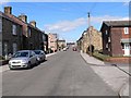


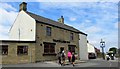
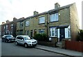
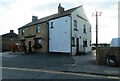
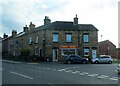
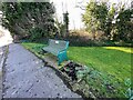
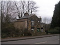
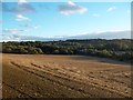
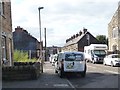
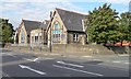
25 photos from this area
Area Information
Key information about the S70 5RZ including its size, population, and administrative classification.
- Area Type
- Postcode
- Area Size
- 6930 m²
- Population
- 1635
- Population Density
- 475 people/km²
House Prices in S70 5RZ
18
Properties
£141,165
Average Sold Price
£55,250
Lowest Price
£263,000
Highest Price
Showing 18 properties
| Address | Type | Beds | Baths | Last Sale Price | Last Sale Date | |
|---|---|---|---|---|---|---|
| 6 Swallow Close, Birdwell, Barnsley, S70 5RZ | Bungalow | 2 | 1 | £220,000 | Aug 2024 | |
| 7 Swallow Close, Birdwell, Barnsley, S70 5RZ | Bungalow | - | - | £263,000 | Dec 2022 | |
| 9 Swallow Close, Birdwell, Barnsley, S70 5RZ | Retail | 3 | 1 | £200,000 | May 2022 | |
| 10 Swallow Close, Birdwell, Barnsley, S70 5RZ | Bungalow | - | - | £130,000 | Mar 2019 | |
| 12 Swallow Close, Birdwell, Barnsley, S70 5RZ | Bungalow | - | - | £140,000 | Dec 2018 | |
| 1 Swallow Close, Birdwell, Barnsley, S70 5RZ | Retail | 3 | - | £148,950 | Jul 2007 | |
| 13 Swallow Close, Birdwell, Barnsley, S70 5RZ | Semi-detached | - | - | £109,000 | Nov 2003 | |
| 17 Swallow Close, Birdwell, Barnsley, S70 5RZ | Detached | - | - | £85,500 | Oct 2001 | |
| 8 Swallow Close, Birdwell, Barnsley, S70 5RZ | Semi-detached | - | - | £59,950 | Apr 1997 | |
| 11 Swallow Close, Birdwell, Barnsley, S70 5RZ | Semi-detached | - | - | £55,250 | Jun 1995 |
Page 1 of 2
Energy Efficiency in S70 5RZ
Amenities
Schools
| Rank | School | Type | Entry gender | Ages |
|---|
Explore more schools in this area
Go to Schools tabDemographics
Household Size
Two person
most common
Accommodation Type
Houses
most common
Tenure
79
majority
Ethnic Group
White
most common
Religion
N/A
most common
Household Composition
N/A
most common
Age
47
median
Adults (30-64 years)
most common
Household Deprivation
N/A
with no deprivation
NS-SEC
30
in Lower managerial occupations
Explore more demographic insights in this area
Go to Demographics tabPlanning
Planning Constraints
- Flood RiskPremium
- Ramsar Wetland SitesPremium
- Area of Outstanding Natural BeautyPremium
- Protected Nature ReservePremium
- Protected WoodlandPremium