Area Overview for S70 5NL
Photos of S70 5NL


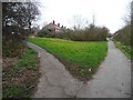
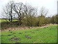
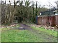
![The former Worsbrough branch canal [lower level] in S70 5NL](https://images.propbar.co.uk/images/geograph/48/73/4873863_120.jpg)
44 photos from this area
Area Information
Key information about the S70 5NL including its size, population, and administrative classification.
- Area Type
- Postcode
- Area Size
- 3.7 hectares
- Population
- 1513
- Population Density
- 415 people/km²
House Prices in S70 5NL
22
Properties
£93,126
Average Sold Price
£32,750
Lowest Price
£250,000
Highest Price
Showing 22 properties
| Address | Type | Beds | Baths | Last Sale Price | Last Sale Date | |
|---|---|---|---|---|---|---|
| 7 Kendal Vale, Worsbrough, Barnsley, S70 5NL | Flat | - | - | £75,000 | Jun 2025 | |
| 25 Kendal Vale, Worsbrough, Barnsley, S70 5NL | Semi-detached | 4 | 1 | £250,000 | Sep 2023 | |
| 3 Kendal Vale, Worsbrough, Barnsley, S70 5NL | Flat | 3 | - | £100,000 | May 2022 | |
| 19 Kendal Vale, Worsbrough, Barnsley, S70 5NL | house | - | - | £125,000 | Apr 2015 | |
| 37 Kendal Vale, Worsbrough, Barnsley, S70 5NL | Detached | 3 | - | £154,500 | Jul 2014 | |
| 45 Kendal Vale, Worsbrough, Barnsley, S70 5NL | Semi-detached | 4 | - | £157,500 | Mar 2014 | |
| 43 Kendal Vale, Worsbrough, Barnsley, S70 5NL | house | 3 | - | £125,000 | Jul 2013 | |
| 11 Kendal Vale, Worsbrough, Barnsley, S70 5NL | house | - | - | £127,500 | Mar 2007 | |
| 21 Kendal Vale, Worsbrough, Barnsley, S70 5NL | Terraced | 3 | - | £138,500 | Apr 2005 | |
| 27 Kendal Vale, Worsbrough, Barnsley, S70 5NL | house | 3 | - | £96,950 | May 2004 |
Page 1 of 3
Energy Efficiency in S70 5NL
Amenities
Schools
| Rank | School | Type | Entry gender | Ages |
|---|
Explore more schools in this area
Go to Schools tabDemographics
Household Size
Two person
most common
Accommodation Type
Houses
most common
Tenure
81
majority
Ethnic Group
White
most common
Religion
N/A
most common
Household Composition
N/A
most common
Age
47
median
Adults (30-64 years)
most common
Household Deprivation
N/A
with no deprivation
NS-SEC
32
in Lower managerial occupations
Explore more demographic insights in this area
Go to Demographics tabPlanning
Planning Constraints
- Flood RiskPremium
- Ramsar Wetland SitesPremium
- Area of Outstanding Natural BeautyPremium
- Protected Nature ReservePremium
- Protected WoodlandPremium