Area Overview for S70 5JN
Photos of S70 5JN
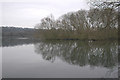
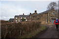
![Turn right [north] for Wingfield Farm's attractions in S70 5JN](https://images.propbar.co.uk/images/geograph/48/70/4870934_120.jpg)
77 photos from this area
Area Information
Key information about the S70 5JN including its size, population, and administrative classification.
- Area Type
- Postcode
- Area Size
- 4146 m²
- Population
- 1513
- Population Density
- 415 people/km²
House Prices in S70 5JN
3
Properties
£120,000
Average Sold Price
£120,000
Lowest Price
£120,000
Highest Price
Showing 3 properties
| Address | Type | Beds | Baths | Last Sale Price | Last Sale Date | |
|---|---|---|---|---|---|---|
| 62 Wigfield Drive, Worsbrough, Barnsley, S70 5JN | Detached | - | - | £120,000 | Mar 2016 | |
| 61 Wigfield Drive, Worsbrough, Barnsley, S70 5JN | Detached | - | - | - | - | |
| Annexe, 62 Wigfield Drive, Worsbrough, Barnsley, S70 5JN | Flat | - | - | - | - |
Energy Efficiency in S70 5JN
Amenities
Schools
| Rank | School | Type | Entry gender | Ages |
|---|
Explore more schools in this area
Go to Schools tabDemographics
Household Size
Two person
most common
Accommodation Type
Houses
most common
Tenure
81
majority
Ethnic Group
White
most common
Religion
N/A
most common
Household Composition
N/A
most common
Age
47
median
Adults (30-64 years)
most common
Household Deprivation
N/A
with no deprivation
NS-SEC
32
in Lower managerial occupations
Explore more demographic insights in this area
Go to Demographics tabPlanning
Planning Constraints
- Flood RiskPremium
- Ramsar Wetland SitesPremium
- Area of Outstanding Natural BeautyPremium
- Protected Nature ReservePremium
- Protected WoodlandPremium