Area Overview for S70 5BE
Photos of S70 5BE
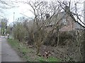
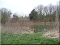
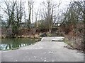
![The former Worsbrough branch canal [lower level] in S70 5BE](https://images.propbar.co.uk/images/geograph/48/73/4873863_120.jpg)
44 photos from this area
Area Information
Key information about the S70 5BE including its size, population, and administrative classification.
- Area Type
- Postcode
- Area Size
- 2.5 hectares
- Population
- 1738
- Population Density
- 5222 people/km²
House Prices in S70 5BE
36
Properties
£286,344
Average Sold Price
£37,000
Lowest Price
£3,000,000
Highest Price
Showing 36 properties
| Address | Type | Beds | Baths | Last Sale Price | Last Sale Date | |
|---|---|---|---|---|---|---|
| 56 Vernon Road, Worsbrough, Barnsley, S70 5BE | Terraced | 3 | 1 | £116,000 | Oct 2024 | |
| 30 Vernon Road, Worsbrough, Barnsley, S70 5BE | house | - | - | £120,000 | Oct 2023 | |
| Ariya House, 70 Vernon Road, Worsbrough, Barnsley, S70 5BE | Flat | - | - | £3,000,000 | Sep 2020 | |
| 60 Vernon Road, Worsbrough, Barnsley, S70 5BE | Semi-detached | 3 | 1 | £130,000 | Jul 2020 | |
| 50 Vernon Road, Worsbrough, Barnsley, S70 5BE | Semi-detached | 3 | 1 | £124,000 | Feb 2019 | |
| 44 Vernon Road, Worsbrough, Barnsley, S70 5BE | house | - | - | £128,000 | Nov 2018 | |
| 58 Vernon Road, Worsbrough, Barnsley, S70 5BE | Semi-detached | 3 | 1 | £125,000 | Nov 2017 | |
| 64 Vernon Road, Worsbrough, Barnsley, S70 5BE | Terraced | - | - | £65,000 | Apr 2015 | |
| 32 Vernon Road, Worsbrough, Barnsley, S70 5BE | Terraced | 3 | - | £80,000 | Jan 2013 | |
| 72 Vernon Road, Worsbrough, Barnsley, S70 5BE | house | 4 | - | £250,000 | Aug 2012 |
Page 1 of 4
Energy Efficiency in S70 5BE
Amenities
Schools
| Rank | School | Type | Entry gender | Ages |
|---|
Explore more schools in this area
Go to Schools tabDemographics
Household Size
One person
most common
Accommodation Type
Houses
most common
Tenure
35
majority
Ethnic Group
White
most common
Religion
N/A
most common
Household Composition
N/A
most common
Age
47
median
Adults (30-64 years)
most common
Household Deprivation
N/A
with no deprivation
NS-SEC
12
in Lower managerial occupations
Explore more demographic insights in this area
Go to Demographics tabPlanning
Planning Constraints
- Flood RiskPremium
- Ramsar Wetland SitesPremium
- Area of Outstanding Natural BeautyPremium
- Protected Nature ReservePremium
- Protected WoodlandPremium