Area Overview for S70 4NF
Photos of S70 4NF

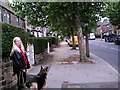
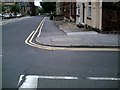
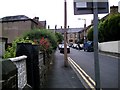
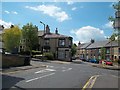
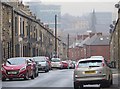
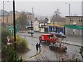
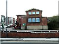
40 photos from this area
Area Information
Key information about the S70 4NF including its size, population, and administrative classification.
- Area Type
- Postcode
- Area Size
- 8029 m²
- Population
- 1580
- Population Density
- 5820 people/km²
House Prices in S70 4NF
17
Properties
£85,383
Average Sold Price
£35,995
Lowest Price
£145,000
Highest Price
Showing 17 properties
| Address | Type | Beds | Baths | Last Sale Price | Last Sale Date | |
|---|---|---|---|---|---|---|
| 4 Warren Quarry Lane, Worsbrough Common, Barnsley, S70 4NF | Detached | 2 | 1 | £140,000 | Nov 2025 | |
| 6 Warren Quarry Lane, Worsbrough Common, Barnsley, S70 4NF | Terraced | 3 | 1 | £108,000 | Mar 2024 | |
| 24 Warren Quarry Lane, Worsbrough Common, Barnsley, S70 4NF | house | - | - | £145,000 | May 2022 | |
| 16 Warren Quarry Lane, Worsbrough Common, Barnsley, S70 4NF | house | - | - | £118,000 | Dec 2019 | |
| 2 Warren Quarry Lane, Worsbrough Common, Barnsley, S70 4NF | house | - | - | £60,000 | Jun 2013 | |
| 10 Warren Quarry Lane, Worsbrough Common, Barnsley, S70 4NF | house | - | - | £85,000 | Aug 2006 | |
| 18 Warren Quarry Lane, Worsbrough Common, Barnsley, S70 4NF | Terraced | - | - | £35,995 | May 2001 | |
| 22 Warren Quarry Lane, Worsbrough Common, Barnsley, S70 4NF | Terraced | - | - | £37,950 | Sep 1999 | |
| 20 Warren Quarry Lane, Worsbrough Common, Barnsley, S70 4NF | Terraced | - | - | £38,500 | Sep 1995 | |
| 12 Warren Quarry Lane, Worsbrough Common, Barnsley, S70 4NF | Terraced | 3 | 1 | - | - |
Page 1 of 2
Energy Efficiency in S70 4NF
Amenities
Schools
| Rank | School | Type | Entry gender | Ages |
|---|
Explore more schools in this area
Go to Schools tabDemographics
Household Size
One person
most common
Accommodation Type
Flats
most common
Tenure
23
majority
Ethnic Group
White
most common
Religion
N/A
most common
Household Composition
N/A
most common
Age
47
median
Adults (30-64 years)
most common
Household Deprivation
N/A
with no deprivation
NS-SEC
13
in Lower managerial occupations
Explore more demographic insights in this area
Go to Demographics tabPlanning
Planning Constraints
- Flood RiskPremium
- Ramsar Wetland SitesPremium
- Area of Outstanding Natural BeautyPremium
- Protected Nature ReservePremium
- Protected WoodlandPremium