Area Overview for S70 3RQ
Photos of S70 3RQ
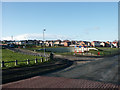
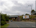
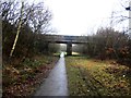
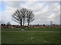
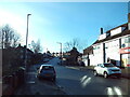
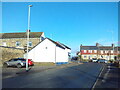
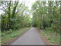
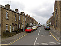
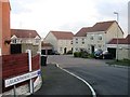
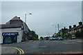
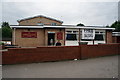
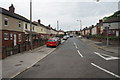
16 photos from this area
Area Information
Key information about the S70 3RQ including its size, population, and administrative classification.
- Area Type
- Postcode
- Area Size
- 7411 m²
- Population
- 2117
- Population Density
- 1374 people/km²
House Prices in S70 3RQ
20
Properties
£73,250
Average Sold Price
£19,000
Lowest Price
£131,000
Highest Price
Showing 20 properties
| Address | Type | Beds | Baths | Last Sale Price | Last Sale Date | |
|---|---|---|---|---|---|---|
| 364 Doncaster Road, Kendray, Barnsley, S70 3RQ | Semi-detached | 3 | 1 | £131,000 | Nov 2022 | |
| 352 Doncaster Road, Kendray, Barnsley, S70 3RQ | house | - | - | £100,000 | May 2022 | |
| 354 Doncaster Road, Kendray, Barnsley, S70 3RQ | house | - | - | £102,000 | May 2021 | |
| 344 Doncaster Road, Kendray, Barnsley, S70 3RQ | house | - | - | £105,000 | Apr 2019 | |
| 239 Doncaster Road, Kendray, Barnsley, S70 3RQ | Semi-detached | 3 | - | £63,000 | Sep 2016 | |
| 346 Doncaster Road, Kendray, Barnsley, S70 3RQ | Semi-detached | 3 | - | £65,000 | Aug 2016 | |
| 241 Doncaster Road, Kendray, Barnsley, S70 3RQ | Semi-detached | 3 | 1 | £61,500 | Feb 2016 | |
| 358 Doncaster Road, Kendray, Barnsley, S70 3RQ | Semi-detached | - | - | £55,000 | Mar 2006 | |
| 360 Doncaster Road, Kendray, Barnsley, S70 3RQ | Semi-detached | - | - | £31,000 | Nov 2000 | |
| 362 Doncaster Road, Kendray, Barnsley, S70 3RQ | Semi-detached | - | - | £19,000 | Apr 1998 |
Page 1 of 2
Energy Efficiency in S70 3RQ
Amenities
Schools
| Rank | School | Type | Entry gender | Ages |
|---|
Explore more schools in this area
Go to Schools tabDemographics
Household Size
One person
most common
Accommodation Type
Houses
most common
Tenure
58
majority
Ethnic Group
White
most common
Religion
N/A
most common
Household Composition
N/A
most common
Age
47
median
Adults (30-64 years)
most common
Household Deprivation
N/A
with no deprivation
NS-SEC
23
in Lower managerial occupations
Explore more demographic insights in this area
Go to Demographics tabPlanning
Planning Constraints
- Flood RiskPremium
- Ramsar Wetland SitesPremium
- Area of Outstanding Natural BeautyPremium
- Protected Nature ReservePremium
- Protected WoodlandPremium