Area Overview for S70 2LB
Photos of S70 2LB

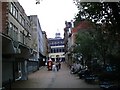
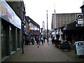
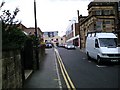

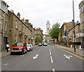

100 photos from this area
Area Information
Key information about the S70 2LB including its size, population, and administrative classification.
- Area Type
- Postcode
- Area Size
- 1.1 hectares
- Population
- 1461
- Population Density
- 4088 people/km²
House Prices in S70 2LB
14
Properties
£101,458
Average Sold Price
£52,000
Lowest Price
£125,000
Highest Price
Showing 14 properties
| Address | Type | Beds | Baths | Last Sale Price | Last Sale Date | |
|---|---|---|---|---|---|---|
| 28 Old Mill Lane, Barnsley, S70 2LB | Terraced | 4 | 1 | £114,000 | Jul 2025 | |
| 40 Old Mill Lane, Barnsley, S70 2LB | Terraced | 3 | 1 | £118,000 | Feb 2022 | |
| 36 Old Mill Lane, Barnsley, S70 2LB | house | - | - | £116,000 | Jun 2021 | |
| 50 Old Mill Lane, Barnsley, S70 2LB | house | - | - | £124,000 | Aug 2018 | |
| 48 Old Mill Lane, Barnsley, S70 2LB | Terraced | 3 | 1 | £125,000 | Jul 2018 | |
| 30 Old Mill Lane, Barnsley, S70 2LB | house | 4 | 1 | £110,000 | Oct 2015 | |
| 32 Old Mill Lane, Barnsley, S70 2LB | Terraced | 3 | - | £72,000 | Nov 2013 | |
| 46 Old Mill Lane, Barnsley, S70 2LB | Terraced | 3 | 1 | £100,000 | Jul 2013 | |
| 54 Old Mill Lane, Barnsley, S70 2LB | Terraced | - | - | £110,500 | May 2008 | |
| 42 Old Mill Lane, Barnsley, S70 2LB | Terraced | 3 | 1 | £85,000 | Nov 2005 |
Page 1 of 2
Energy Efficiency in S70 2LB
Amenities
Schools
| Rank | School | Type | Entry gender | Ages |
|---|
Explore more schools in this area
Go to Schools tabDemographics
Household Size
Two person
most common
Accommodation Type
Houses
most common
Tenure
74
majority
Ethnic Group
White
most common
Religion
N/A
most common
Household Composition
N/A
most common
Age
47
median
Adults (30-64 years)
most common
Household Deprivation
N/A
with no deprivation
NS-SEC
36
in Lower managerial occupations
Explore more demographic insights in this area
Go to Demographics tabPlanning
Planning Constraints
- Flood RiskPremium
- Ramsar Wetland SitesPremium
- Area of Outstanding Natural BeautyPremium
- Protected Nature ReservePremium
- Protected WoodlandPremium