Area Overview for S7 2DX
Photos of S7 2DX
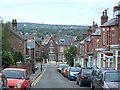
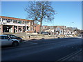
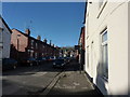
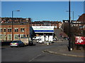
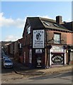
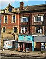
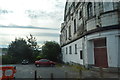
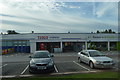
99 photos from this area
Area Information
Key information about the S7 2DX including its size, population, and administrative classification.
- Area Type
- Postcode
- Area Size
- 1.4 hectares
- Population
- 1344
- Population Density
- 6208 people/km²
House Prices in S7 2DX
53
Properties
£259,802
Average Sold Price
£65,000
Lowest Price
£572,000
Highest Price
Showing 53 properties
| Address | Type | Beds | Baths | Last Sale Price | Last Sale Date | |
|---|---|---|---|---|---|---|
| 8 Carter Knowle Road, Sheffield, S7 2DX | Semi-detached | 6 | 2 | £380,000 | Oct 2024 | |
| 34 Carter Knowle Road, Sheffield, S7 2DX | Semi-detached | 4 | 1 | £425,000 | Dec 2023 | |
| 42 Carter Knowle Road, Sheffield, S7 2DX | Terraced | 6 | 5 | £543,000 | Oct 2021 | |
| 18 Carter Knowle Road, Sheffield, S7 2DX | Semi-detached | 5 | - | £500,000 | Sep 2021 | |
| 22 Carter Knowle Road, Sheffield, S7 2DX | Semi-detached | 5 | 2 | £572,000 | Jun 2021 | |
| 58 Carter Knowle Road, Sheffield, S7 2DX | Semi-detached | 5 | 1 | £320,000 | Mar 2018 | |
| 6 Carter Knowle Road, Sheffield, S7 2DX | Semi-detached | 4 | 2 | £260,000 | Aug 2016 | |
| 56 Carter Knowle Road, Sheffield, S7 2DX | Semi-detached | 4 | 1 | £280,000 | Oct 2014 | |
| 70 Carter Knowle Road, Sheffield, S7 2DX | Semi-detached | 5 | - | £320,000 | Aug 2014 | |
| 28 Carter Knowle Road, Sheffield, S7 2DX | Semi-detached | 5 | - | £280,000 | Jul 2014 |
Page 1 of 6
Energy Efficiency in S7 2DX
Amenities
Schools
| Rank | School | Type | Entry gender | Ages |
|---|
Explore more schools in this area
Go to Schools tabDemographics
Household Size
Family (3-5 people)
most common
Accommodation Type
Houses
most common
Tenure
73
majority
Ethnic Group
White
most common
Religion
N/A
most common
Household Composition
N/A
most common
Age
47
median
Adults (30-64 years)
most common
Household Deprivation
N/A
with no deprivation
NS-SEC
47
in Lower managerial occupations
Explore more demographic insights in this area
Go to Demographics tabPlanning
Planning Constraints
- Flood RiskPremium
- Ramsar Wetland SitesPremium
- Area of Outstanding Natural BeautyPremium
- Protected Nature ReservePremium
- Protected WoodlandPremium