Area Overview for S7 2BZ
Photos of S7 2BZ
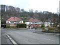

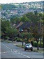
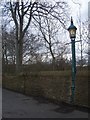
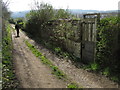
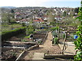
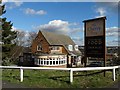
61 photos from this area
Area Information
Key information about the S7 2BZ including its size, population, and administrative classification.
- Area Type
- Postcode
- Area Size
- 9278 m²
- Population
- 1611
- Population Density
- 7897 people/km²
House Prices in S7 2BZ
25
Properties
£230,350
Average Sold Price
£54,500
Lowest Price
£400,000
Highest Price
Showing 25 properties
| Address | Type | Beds | Baths | Last Sale Price | Last Sale Date | |
|---|---|---|---|---|---|---|
| 39 Swaledale Road, Sheffield, S7 2BZ | Detached | 3 | 1 | £350,000 | Nov 2025 | |
| 68 Swaledale Road, Sheffield, S7 2BZ | Semi-detached | 4 | 2 | £368,000 | Oct 2024 | |
| 59 Swaledale Road, Sheffield, S7 2BZ | Semi-detached | 3 | - | £265,000 | Aug 2020 | |
| 62 Swaledale Road, Sheffield, S7 2BZ | Semi-detached | 4 | 2 | £400,000 | Jan 2020 | |
| 70 Swaledale Road, Sheffield, S7 2BZ | house | 3 | 2 | £380,000 | Apr 2018 | |
| 56 Swaledale Road, Sheffield, S7 2BZ | Semi-detached | 3 | 1 | £253,000 | Mar 2017 | |
| 57 Swaledale Road, Sheffield, S7 2BZ | Semi-detached | 3 | 1 | £231,500 | Jul 2016 | |
| 33 Swaledale Road, Sheffield, S7 2BZ | Semi-detached | 3 | - | £195,500 | Nov 2014 | |
| 51 Swaledale Road, Sheffield, S7 2BZ | house | 3 | - | £182,000 | Oct 2011 | |
| 61 Swaledale Road, Sheffield, S7 2BZ | Semi-detached | - | - | £175,500 | Jul 2006 |
Page 1 of 3
Energy Efficiency in S7 2BZ
Amenities
Schools
| Rank | School | Type | Entry gender | Ages |
|---|
Explore more schools in this area
Go to Schools tabDemographics
Household Size
Two person
most common
Accommodation Type
Houses
most common
Tenure
61
majority
Ethnic Group
White
most common
Religion
N/A
most common
Household Composition
N/A
most common
Age
47
median
Adults (30-64 years)
most common
Household Deprivation
N/A
with no deprivation
NS-SEC
42
in Lower managerial occupations
Explore more demographic insights in this area
Go to Demographics tabPlanning
Planning Constraints
- Flood RiskPremium
- Ramsar Wetland SitesPremium
- Area of Outstanding Natural BeautyPremium
- Protected Nature ReservePremium
- Protected WoodlandPremium