Area Overview for S66 8SJ
Photos of S66 8SJ


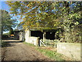
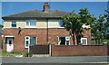
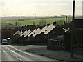

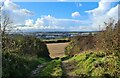
13 photos from this area
Area Information
Key information about the S66 8SJ including its size, population, and administrative classification.
- Area Type
- Postcode
- Area Size
- 7426 m²
- Population
- 1381
- Population Density
- 4310 people/km²
House Prices in S66 8SJ
15
Properties
£113,829
Average Sold Price
£55,000
Lowest Price
£216,500
Highest Price
Showing 15 properties
| Address | Type | Beds | Baths | Last Sale Price | Last Sale Date | |
|---|---|---|---|---|---|---|
| 9 Gala Crescent, Maltby, Rotherham, S66 8SJ | Detached | 3 | 1 | £212,500 | Oct 2022 | |
| 1 Gala Crescent, Maltby, Rotherham, S66 8SJ | house | - | - | £216,500 | Dec 2021 | |
| 12 Gala Crescent, Maltby, Rotherham, S66 8SJ | Detached | - | - | £164,500 | Nov 2007 | |
| 7 Gala Crescent, Maltby, Rotherham, S66 8SJ | Detached | - | - | £155,000 | Jan 2007 | |
| 4 Gala Crescent, Maltby, Rotherham, S66 8SJ | Detached | - | - | £187,000 | Dec 2005 | |
| 15 Gala Crescent, Maltby, Rotherham, S66 8SJ | Detached | - | - | £124,000 | Apr 2004 | |
| 17 Gala Crescent, Maltby, Rotherham, S66 8SJ | Detached | - | - | £124,500 | Dec 2003 | |
| 19 Gala Crescent, Maltby, Rotherham, S66 8SJ | Detached | - | - | £67,000 | May 2001 | |
| 2 Gala Crescent, Maltby, Rotherham, S66 8SJ | Detached | - | - | £89,950 | Jan 2001 | |
| 5 Gala Crescent, Maltby, Rotherham, S66 8SJ | Detached | - | - | £65,000 | Dec 2000 |
Page 1 of 2
Energy Efficiency in S66 8SJ
Amenities
Schools
| Rank | School | Type | Entry gender | Ages |
|---|
Explore more schools in this area
Go to Schools tabDemographics
Household Size
Two person
most common
Accommodation Type
Houses
most common
Tenure
88
majority
Ethnic Group
White
most common
Religion
N/A
most common
Household Composition
N/A
most common
Age
47
median
Adults (30-64 years)
most common
Household Deprivation
N/A
with no deprivation
NS-SEC
32
in Lower managerial occupations
Explore more demographic insights in this area
Go to Demographics tabPlanning
Planning Constraints
- Flood RiskPremium
- Ramsar Wetland SitesPremium
- Area of Outstanding Natural BeautyPremium
- Protected Nature ReservePremium
- Protected WoodlandPremium