Area Overview for S66 8EH
Photos of S66 8EH
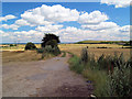
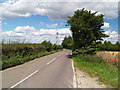
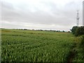
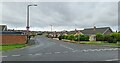
9 photos from this area
Area Information
Key information about the S66 8EH including its size, population, and administrative classification.
- Area Type
- Postcode
- Area Size
- 26.8 hectares
- Population
- 1626
- Population Density
- 57 people/km²
House Prices in S66 8EH
72
Properties
£147,990
Average Sold Price
£45,000
Lowest Price
£420,000
Highest Price
Showing 72 properties
| Address | Type | Beds | Baths | Last Sale Price | Last Sale Date | |
|---|---|---|---|---|---|---|
| 47 Amorys Holt Road, Maltby, Rotherham, S66 8EH | Detached | 4 | 2 | £390,000 | Mar 2025 | |
| 40 Amorys Holt Road, Maltby, Rotherham, S66 8EH | Bungalow | 2 | 1 | £220,000 | Feb 2024 | |
| 79 Amorys Holt Road, Maltby, Rotherham, S66 8EH | Detached | 4 | 2 | £420,000 | Nov 2023 | |
| 44 Amorys Holt Road, Maltby, Rotherham, S66 8EH | Semi-detached | 3 | 1 | £147,000 | Oct 2023 | |
| 27 Amorys Holt Road, Maltby, Rotherham, S66 8EH | Bungalow | 2 | 1 | £195,000 | Sep 2023 | |
| 50 Amorys Holt Road, Maltby, Rotherham, S66 8EH | house | 4 | 2 | £275,000 | Jul 2023 | |
| 12 Amorys Holt Road, Maltby, Rotherham, S66 8EH | Detached | 3 | 1 | £201,000 | Apr 2023 | |
| 73 Amorys Holt Road, Maltby, Rotherham, S66 8EH | Retail | 3 | 2 | £235,000 | May 2022 | |
| 1 Amorys Holt Road, Maltby, Rotherham, S66 8EH | Detached | 3 | 1 | £138,500 | Mar 2021 | |
| 28 Amorys Holt Road, Maltby, Rotherham, S66 8EH | Detached | 3 | 1 | £140,000 | May 2019 |
Page 1 of 8
Energy Efficiency in S66 8EH
Amenities
Schools
| Rank | School | Type | Entry gender | Ages |
|---|
Explore more schools in this area
Go to Schools tabDemographics
Household Size
Two person
most common
Accommodation Type
Houses
most common
Tenure
83
majority
Ethnic Group
White
most common
Religion
N/A
most common
Household Composition
N/A
most common
Age
47
median
Adults (30-64 years)
most common
Household Deprivation
N/A
with no deprivation
NS-SEC
39
in Lower managerial occupations
Explore more demographic insights in this area
Go to Demographics tabPlanning
Planning Constraints
- Flood RiskPremium
- Ramsar Wetland SitesPremium
- Area of Outstanding Natural BeautyPremium
- Protected Nature ReservePremium
- Protected WoodlandPremium