Area Overview for S66 8AZ
Photos of S66 8AZ


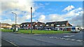
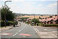


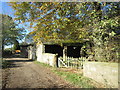
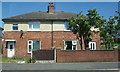


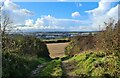
13 photos from this area
Area Information
Key information about the S66 8AZ including its size, population, and administrative classification.
- Area Type
- Postcode
- Area Size
- 3.6 hectares
- Population
- 1317
- Population Density
- 1761 people/km²
House Prices in S66 8AZ
37
Properties
£107,898
Average Sold Price
£18,700
Lowest Price
£215,000
Highest Price
Showing 37 properties
| Address | Type | Beds | Baths | Last Sale Price | Last Sale Date | |
|---|---|---|---|---|---|---|
| 10 Larch Road, Maltby, Rotherham, S66 8AZ | Semi-detached | 4 | 2 | £215,000 | Oct 2025 | |
| 5 Larch Road, Maltby, Rotherham, S66 8AZ | Semi-detached | 3 | 1 | £175,000 | Jun 2023 | |
| 6 Larch Road, Maltby, Rotherham, S66 8AZ | house | - | - | £160,000 | Jan 2022 | |
| 29 Larch Road, Maltby, Rotherham, S66 8AZ | Semi-detached | 3 | 1 | £122,000 | Feb 2021 | |
| 35 Larch Road, Maltby, Rotherham, S66 8AZ | Semi-detached | 3 | 1 | £142,500 | Sep 2020 | |
| 8 Larch Road, Maltby, Rotherham, S66 8AZ | Semi-detached | 3 | - | £132,500 | May 2020 | |
| 17 Larch Road, Maltby, Rotherham, S66 8AZ | Semi-detached | 3 | - | £125,000 | May 2019 | |
| 51 Larch Road, Maltby, Rotherham, S66 8AZ | Semi-detached | 3 | - | £125,000 | Aug 2018 | |
| 41 Larch Road, Maltby, Rotherham, S66 8AZ | Semi-detached | 3 | - | £130,000 | May 2018 | |
| 45 Larch Road, Maltby, Rotherham, S66 8AZ | Semi-detached | 3 | 1 | £128,500 | Apr 2017 |
Page 1 of 4
Energy Efficiency in S66 8AZ
Amenities
Schools
| Rank | School | Type | Entry gender | Ages |
|---|
Explore more schools in this area
Go to Schools tabDemographics
Household Size
Family (3-5 people)
most common
Accommodation Type
Houses
most common
Tenure
85
majority
Ethnic Group
White
most common
Religion
N/A
most common
Household Composition
N/A
most common
Age
47
median
Adults (30-64 years)
most common
Household Deprivation
N/A
with no deprivation
NS-SEC
35
in Lower managerial occupations
Explore more demographic insights in this area
Go to Demographics tabPlanning
Planning Constraints
- Flood RiskPremium
- Ramsar Wetland SitesPremium
- Area of Outstanding Natural BeautyPremium
- Protected Nature ReservePremium
- Protected WoodlandPremium