Area Overview for S66 2HX
Photos of S66 2HX
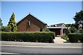
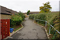
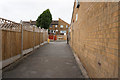
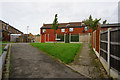
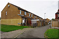
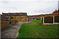
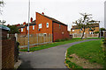
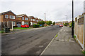
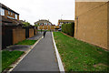
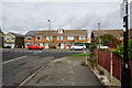
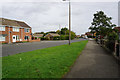
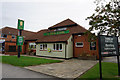
20 photos from this area
Area Information
Key information about the S66 2HX including its size, population, and administrative classification.
- Area Type
- Postcode
- Area Size
- 8738 m²
- Population
- 1421
- Population Density
- 3566 people/km²
House Prices in S66 2HX
26
Properties
£139,746
Average Sold Price
£49,500
Lowest Price
£255,000
Highest Price
Showing 26 properties
| Address | Type | Beds | Baths | Last Sale Price | Last Sale Date | |
|---|---|---|---|---|---|---|
| 24 Harvest Road, Wickersley, Rotherham, S66 2HX | house | - | - | £200,000 | Feb 2022 | |
| 14 Harvest Road, Wickersley, Rotherham, S66 2HX | Semi-detached | 3 | 2 | £255,000 | Oct 2020 | |
| 2 Harvest Road, Wickersley, Rotherham, S66 2HX | house | - | - | £207,000 | Oct 2020 | |
| 26 Harvest Road, Wickersley, Rotherham, S66 2HX | house | - | - | £175,000 | Jul 2019 | |
| 12 Harvest Road, Wickersley, Rotherham, S66 2HX | Semi-detached | 2 | 1 | £147,500 | Apr 2018 | |
| 3 Harvest Road, Wickersley, Rotherham, S66 2HX | Semi-detached | 3 | 1 | £180,000 | May 2016 | |
| 19 Harvest Road, Wickersley, Rotherham, S66 2HX | Semi-detached | 3 | 1 | £138,000 | Nov 2013 | |
| 1 Harvest Road, Wickersley, Rotherham, S66 2HX | house | - | - | £164,000 | Oct 2011 | |
| 10 Harvest Road, Wickersley, Rotherham, S66 2HX | Semi-detached | - | - | £168,000 | Apr 2007 | |
| 11 Harvest Road, Wickersley, Rotherham, S66 2HX | Semi-detached | - | - | £74,950 | Jul 2000 |
Page 1 of 3
Energy Efficiency in S66 2HX
Amenities
Schools
| Rank | School | Type | Entry gender | Ages |
|---|
Explore more schools in this area
Go to Schools tabDemographics
Household Size
One person
most common
Accommodation Type
Houses
most common
Tenure
79
majority
Ethnic Group
White
most common
Religion
N/A
most common
Household Composition
N/A
most common
Age
47
median
Elderly (65+ years)
most common
Household Deprivation
N/A
with no deprivation
NS-SEC
36
in Lower managerial occupations
Explore more demographic insights in this area
Go to Demographics tabPlanning
Planning Constraints
- Flood RiskPremium
- Ramsar Wetland SitesPremium
- Area of Outstanding Natural BeautyPremium
- Protected Nature ReservePremium
- Protected WoodlandPremium