Area Overview for S66 2BP
Photos of S66 2BP
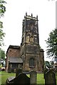
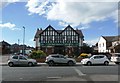
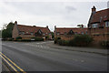
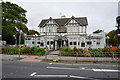
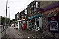
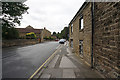
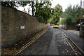
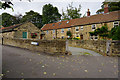
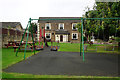
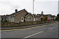
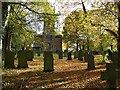
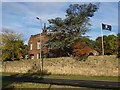
24 photos from this area
Area Information
Key information about the S66 2BP including its size, population, and administrative classification.
- Area Type
- Postcode
- Area Size
- 1.5 hectares
- Population
- 1485
- Population Density
- 4373 people/km²
House Prices in S66 2BP
34
Properties
£156,071
Average Sold Price
£48,500
Lowest Price
£290,000
Highest Price
Showing 34 properties
| Address | Type | Beds | Baths | Last Sale Price | Last Sale Date | |
|---|---|---|---|---|---|---|
| 50 The Grove, Wickersley, Rotherham, S66 2BP | Semi-detached | 3 | 1 | £282,000 | Jul 2025 | |
| 60 The Grove, Wickersley, Rotherham, S66 2BP | Semi-detached | 3 | 1 | £290,000 | Jul 2024 | |
| 28 The Grove, Wickersley, Rotherham, S66 2BP | Semi-detached | 3 | 1 | £250,000 | Jun 2023 | |
| 40 The Grove, Wickersley, Rotherham, S66 2BP | Detached | 3 | 1 | £235,000 | Apr 2023 | |
| 48 The Grove, Wickersley, Rotherham, S66 2BP | house | - | - | £210,000 | Jun 2021 | |
| 2 The Grove, Wickersley, Rotherham, S66 2BP | Semi-detached | 3 | 2 | £185,000 | Aug 2019 | |
| 14 The Grove, Wickersley, Rotherham, S66 2BP | Semi-detached | 3 | - | £162,000 | Nov 2010 | |
| 32 The Grove, Wickersley, Rotherham, S66 2BP | house | 3 | 1 | £165,000 | Aug 2009 | |
| 62 The Grove, Wickersley, Rotherham, S66 2BP | Semi-detached | - | - | £175,000 | Dec 2007 | |
| 58 The Grove, Wickersley, Rotherham, S66 2BP | Semi-detached | - | - | £125,000 | Jun 2007 |
Page 1 of 4
Energy Efficiency in S66 2BP
Amenities
Schools
| Rank | School | Type | Entry gender | Ages |
|---|
Explore more schools in this area
Go to Schools tabDemographics
Household Size
Two person
most common
Accommodation Type
Houses
most common
Tenure
50
majority
Ethnic Group
White
most common
Religion
N/A
most common
Household Composition
N/A
most common
Age
47
median
Adults (30-64 years)
most common
Household Deprivation
N/A
with no deprivation
NS-SEC
31
in Lower managerial occupations
Explore more demographic insights in this area
Go to Demographics tabPlanning
Planning Constraints
- Flood RiskPremium
- Ramsar Wetland SitesPremium
- Area of Outstanding Natural BeautyPremium
- Protected Nature ReservePremium
- Protected WoodlandPremium