Area Overview for S66 1EH
Photos of S66 1EH

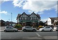
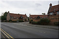
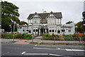

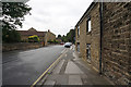
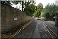
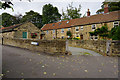
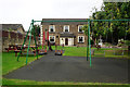
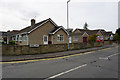


24 photos from this area
Area Information
Key information about the S66 1EH including its size, population, and administrative classification.
- Area Type
- Postcode
- Area Size
- 2.1 hectares
- Population
- 1709
- Population Density
- 552 people/km²
House Prices in S66 1EH
33
Properties
£227,326
Average Sold Price
£48,000
Lowest Price
£490,000
Highest Price
Showing 33 properties
| Address | Type | Beds | Baths | Last Sale Price | Last Sale Date | |
|---|---|---|---|---|---|---|
| 9 Gillott Lane, Wickersley, Rotherham, S66 1EH | Semi-detached | 3 | 2 | £270,000 | May 2025 | |
| 17 Gillott Lane, Wickersley, Rotherham, S66 1EH | Retail | 2 | - | £185,000 | Jul 2022 | |
| 53 Gillott Lane, Wickersley, Rotherham, S66 1EH | Detached | 4 | - | £490,000 | Jun 2021 | |
| 4 Gillott Lane, Wickersley, Rotherham, S66 1EH | house | - | - | £312,000 | Apr 2021 | |
| 45 Gillott Lane, Wickersley, Rotherham, S66 1EH | Bungalow | 2 | 1 | £264,000 | Jan 2020 | |
| 12 Gillott Lane, Wickersley, Rotherham, S66 1EH | Detached | 4 | 1 | £425,000 | Apr 2019 | |
| 4A Gillott Lane, Wickersley, Rotherham, S66 1EH | Detached | 3 | 2 | £365,000 | Oct 2017 | |
| 16 Gillott Lane, Wickersley, Rotherham, S66 1EH | Detached | 4 | - | £335,000 | Sep 2017 | |
| 49 Gillott Lane, Wickersley, Rotherham, S66 1EH | Detached | - | - | £430,000 | Oct 2009 | |
| 19 Gillott Lane, Wickersley, Rotherham, S66 1EH | Semi-detached | - | - | £209,950 | Jul 2006 |
Page 1 of 4
Energy Efficiency in S66 1EH
Amenities
Schools
| Rank | School | Type | Entry gender | Ages |
|---|
Explore more schools in this area
Go to Schools tabDemographics
Household Size
Two person
most common
Accommodation Type
Houses
most common
Tenure
89
majority
Ethnic Group
White
most common
Religion
N/A
most common
Household Composition
N/A
most common
Age
47
median
Adults (30-64 years)
most common
Household Deprivation
N/A
with no deprivation
NS-SEC
47
in Lower managerial occupations
Explore more demographic insights in this area
Go to Demographics tabPlanning
Planning Constraints
- Flood RiskPremium
- Ramsar Wetland SitesPremium
- Area of Outstanding Natural BeautyPremium
- Protected Nature ReservePremium
- Protected WoodlandPremium