Area Overview for S65 4NS
Photos of S65 4NS
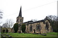
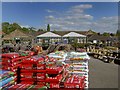
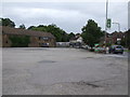
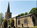
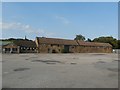
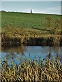
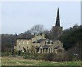
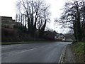
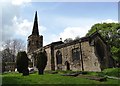
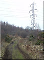
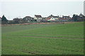
20 photos from this area
Area Information
Key information about the S65 4NS including its size, population, and administrative classification.
- Area Type
- Postcode
- Area Size
- 24.6 hectares
- Population
- 1524
- Population Density
- 168 people/km²
House Prices in S65 4NS
27
Properties
£392,857
Average Sold Price
£250,000
Lowest Price
£540,000
Highest Price
Showing 27 properties
| Address | Type | Beds | Baths | Last Sale Price | Last Sale Date | |
|---|---|---|---|---|---|---|
| The Coppins, 179 Doncaster Road, Thrybergh, Rotherham, S65 4NS | Detached | 5 | 2 | £540,000 | Aug 2022 | |
| Manor Cottage, 183 Doncaster Road, Thrybergh, Rotherham, S65 4NS | Detached | 3 | 1 | £270,000 | Mar 2022 | |
| Chestnut Tree Farm, Doncaster Road, Thrybergh, Rotherham, S65 4NS | Detached | 5 | - | £535,000 | Jun 2021 | |
| The Old Post Office, 160 Doncaster Road, Thrybergh, Rotherham, S65 4NS | Detached | 3 | 2 | £280,000 | Oct 2020 | |
| Manor Close, 185 Doncaster Road, Thrybergh, Rotherham, S65 4NS | house | - | - | £440,000 | Jul 2019 | |
| Manor Farm, Doncaster Road, Thrybergh, Rotherham, S65 4NS | Land | 5 | - | £435,000 | Dec 2005 | |
| The Stables, Doncaster Road, Thrybergh, Rotherham, S65 4NS | Bungalow | 2 | - | £250,000 | Jun 2005 | |
| 177B Doncaster Road, Thrybergh, Rotherham, S65 4NS | Detached | 3 | 2 | - | - | |
| Apartment 3, Manor House, 181 Doncaster Road, Thrybergh, Rotherham, S65 4NS | Flat | 2 | 2 | - | - | |
| 177C Doncaster Road, Thrybergh, Rotherham, S65 4NS | Flat | 2 | - | - | - |
Page 1 of 3
Energy Efficiency in S65 4NS
Amenities
Schools
| Rank | School | Type | Entry gender | Ages |
|---|
Explore more schools in this area
Go to Schools tabDemographics
Household Size
Two person
most common
Accommodation Type
Houses
most common
Tenure
70
majority
Ethnic Group
White
most common
Religion
N/A
most common
Household Composition
N/A
most common
Age
47
median
Adults (30-64 years)
most common
Household Deprivation
N/A
with no deprivation
NS-SEC
27
in Lower managerial occupations
Explore more demographic insights in this area
Go to Demographics tabPlanning
Planning Constraints
- Flood RiskPremium
- Ramsar Wetland SitesPremium
- Area of Outstanding Natural BeautyPremium
- Protected Nature ReservePremium
- Protected WoodlandPremium