Area Overview for S65 4GJ
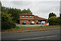
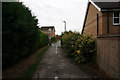
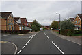
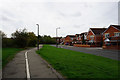
Photos of S65 4GJ
Area Information
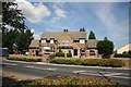
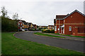
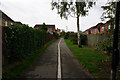
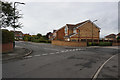
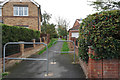
The postcode area S65 4GJ serves as a distinct residential cluster within the broader Greater Sheffield region. It covers a total area of 3,678 square metres, housing a population of 2,028 residents. This compact footprint results in a population density of 789 people per square kilometre. The space is primarily dedicated to housing, supporting a community where the majority of homes are privately owned. Living in S65 4GJ means accessing a settlement that balances residential density with local infrastructure. The area functions as a self-contained residential unit where daily life revolves around proximity to essential services and transport links.
- Area Type
- Postcode
- Area Size
- 3678 m²
- Population
- 2028
- Population Density
- 789 people/km²
Living in S65 4GJ places you in a market dominated by owner-occupiers rather than landlords or investors. The data confirms that 84 per cent of the housing stock is owned by its residents. This high ownership rate points to a community where households have remained in their properties for significant periods. The accommodation type consists entirely of houses, meaning you will find no flats or bungalows within this specific cluster. This uniformity suggests a consistent architectural style and a neighbourhood designed for family life rather than city living. Buyers seeking houses in S65 4GJ are entering a territory where the property market is driven by long-term owners. The absence of rental accommodation indicates that the local estate market likely operates with low turnover.
House Prices in S65 4GJ
Showing 27 properties
| Address | Type | Beds | Baths | Last Sale Price | Last Sale Date | |
|---|---|---|---|---|---|---|
| 2 Buttercup Boulevard, Ravenfield, Rotherham, S65 4GJ | house | - | - | £403,000 | Mar 2025 | |
| 3 Buttercup Boulevard, Ravenfield, Rotherham, S65 4GJ | house | - | - | £441,750 | Feb 2025 | |
| 7 Buttercup Boulevard, Ravenfield, Rotherham, S65 4GJ | house | - | - | £380,000 | Feb 2025 | |
| 4 Buttercup Boulevard, Ravenfield, Rotherham, S65 4GJ | house | - | - | £473,000 | Dec 2024 | |
| 6 Buttercup Boulevard, Ravenfield, Rotherham, S65 4GJ | house | - | - | £520,000 | Jun 2024 | |
| 14 Buttercup Boulevard, Ravenfield, Rotherham, S65 4GJ | house | - | - | - | - | |
| 26 Buttercup Boulevard, Ravenfield, Rotherham, S65 4GJ | house | - | - | - | - | |
| 27 Buttercup Boulevard, Ravenfield, Rotherham, S65 4GJ | house | - | - | - | - | |
| 34 Buttercup Boulevard, Ravenfield, Rotherham, S65 4GJ | house | - | - | - | - | |
| 17 Buttercup Boulevard, Ravenfield, Rotherham, S65 4GJ | house | - | - | - | - |
Energy Efficiency in S65 4GJ
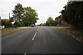
Your daily life in S65 4GJ is supported by a practical network of shops and transport hubs within practical reach. Retail options include Co-op Woodlaithes, Sainsburys Sunnyside, and Aldi Bramley, ensuring you never need to travel far for groceries. You have convenient access to three metro stations, specifically Parkgate, Rotherham Platform Both Directions, and Meadowhall South. Rail networks are equally accessible via Swinton Railway Station, Rotherham Central Railway Station, and Conisbrough Railway Station. These five rail stations and three metro stations connect you quickly to Sheffield and beyond. The nearby amenities offer the essential shopping and transport convenience required for a modern, independent lifestyle.
Amenities
Schools
Families considering homes near S65 4GJ have access to two primary educational institutions close to their door. Ravenfield Primary School and Ravenfield Primary Academy are both located nearby and offer primary education to local children. Both establishments are of the primary type, catering to pupils from the early years up to the end of key stage two. As no secondary schools are listed in the immediate vicinity, families often need to look further for secondary education. The presence of two separate primary schools provides choices for parents within the same locality. These schools form a significant part of the daily routine for residents raising children in the area.
| Rank | School | Type | Entry gender | Ages |
|---|
Explore more schools in this area
Go to Schools tabDemographics
The community within S65 4GJ is defined by a mature demographic profile. The median age is 47 years, with adults aged between 30 and 64 years representing the most common age range. This age structure suggests a neighbourhood likely populated by families with grown children or established couples. Home ownership is a defining feature, with 84 per cent of residents owning their dwellings. The accommodation type is exclusively houses, reflecting a preference for traditional domestic living over apartment living. The predominant ethnic group is White, contributing to the local cultural character. With such a high rate of ownership, the area reflects long-term settlement rather than a transient rental market. These figures indicate a stable population that has invested in the area over many years.
Household Size
Accommodation Type
Tenure
Ethnic Group
Religion
Household Composition
Age
Household Deprivation
NS-SEC
Explore more demographic insights in this area
Go to Demographics tabPlanning
Planning Constraints
- Flood RiskPremium
- Ramsar Wetland SitesPremium
- Area of Outstanding Natural BeautyPremium
- Protected Nature ReservePremium
- Protected WoodlandPremium