Area Overview for S65 3RR
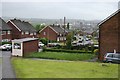
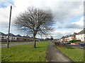
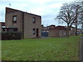
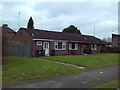
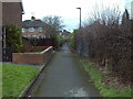
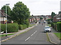
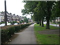
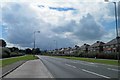
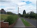
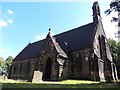
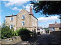
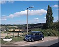
Photos of S65 3RR
Area Information
Living in S65 3RR means settling into a very small, tightly defined residential cluster within England. This specific postcode covers just 5,939 square metres, creating an intimate environment with a population of 1,431 people. The low physical footprint suggests a neighbourhood where residents know one another well, though the boundaries are strictly confined to this tiny area rather than extending across wider streets or amenities. Daily life here is characterised by a distinct focus on the immediate surroundings, as the area itself is smaller than many city blocks elsewhere. You need to know that while the cluster is compact, access to essential services relies entirely on reaching nearby transport hubs and retail sites just a short distance away. The community is established and stands out for its high concentration of households within such a limited space. Expect a slower pace than larger urban zones, with every home or street being part of this uniquely compact arrangement. The area functions as a dedicated sleeping quarter for those who work or access other facilities in the broader Rotherham or Sheffield vicinity.
- Area Type
- Postcode
- Area Size
- 5939 m²
- Population
- 1431
- Population Density
- 2649 people/km²
The property market in S65 3RR is dominated by houses, distinguishing it from urban centres where flats are the norm. With 33 per cent home ownership, this indicates a largely rental neighbourhood where two-thirds of the population rents their dwellings. This dynamic often drives costs higher for those looking to buy, as the limited supply of owner-occupied homes competes against a growing demand from the renting majority. The accommodation type data confirms that you will find houses as the primary dwelling style within this specific postcode. Prospective buyers must look beyond the 5,939 square metres of this exact postcode to find a wider range of options, as the immediate cluster itself offers a constrained selection. The high proportion of renters suggests that local landlords and letting agents play a more visible role than traditional estate managers solely focused on owner-occupier sales. When considering homes in S65 3RR, you are joining a neighbourhood where established residents coexist with a significant cohort of tenants, creating a transient element within an age-stable population.
House Prices in S65 3RR
Showing 12 properties
| Address | Type | Beds | Baths | Last Sale Price | Last Sale Date | |
|---|---|---|---|---|---|---|
| 3 Cawthorne Road, East Herringthorpe, Rotherham, S65 3RR | Semi-detached | 3 | 1 | £108,000 | Apr 2023 | |
| 7 Cawthorne Road, East Herringthorpe, Rotherham, S65 3RR | Semi-detached | 3 | 1 | £105,000 | Nov 2018 | |
| 2 Cawthorne Road, East Herringthorpe, Rotherham, S65 3RR | house | - | - | - | - | |
| 13 Cawthorne Road, East Herringthorpe, Rotherham, S65 3RR | house | - | - | - | - | |
| 4 Cawthorne Road, East Herringthorpe, Rotherham, S65 3RR | Semi-detached | - | - | - | - | |
| 17 Cawthorne Road, East Herringthorpe, Rotherham, S65 3RR | Semi-detached | - | - | - | - | |
| 1 Cawthorne Road, East Herringthorpe, Rotherham, S65 3RR | house | - | - | - | - | |
| 9 Cawthorne Road, East Herringthorpe, Rotherham, S65 3RR | house | - | - | - | - | |
| 5 Cawthorne Road, East Herringthorpe, Rotherham, S65 3RR | Semi-detached | - | - | - | - | |
| 6 Cawthorne Road, East Herringthorpe, Rotherham, S65 3RR | house | - | - | - | - |
Energy Efficiency in S65 3RR
Your access to amenities in S65 3RR relies on reaching nearby venues, with five retail, five metro, and five rail sites within practical reach. For shoppers, Heron East, Iceland Sycamore, and Asda Rotherham serve as the main retail destinations for groceries and daily necessities. The metro network includes stations at Parkgate, Rotherham Platform Both Directions, and Meadowhall South, providing extensive local bus links. Rail connectivity is strong with Rotherham Central Railway Station, Swinton Railway Station, and Meadowhall Railway Station offering high-speed and frequent local trains. This network allows you to commute directly to major employment hubs or catch regional services with ease. The proximity of Asda Rotherham ensures you can travel to comprehensive retail parks for weekly shopping without long drives. The variety of rail options means you are not reliant on a single line for your daily commute. Living in this area gives you the convenience of a suburban home with the transport accessibility of a city centre location. You can access these facilities quickly, making the small size of the postcode area feel less isolated.
Amenities
Schools
Families considering schools near S65 3RR have access to a solid mix of early years and primary education providers. You can choose from Arnold Nursery School and Children's Centre for the youngest children in the cluster. For primary education, Badsley Primary School holds a 'good' Ofsted rating, offering a verified quality standard for your children's learning. Badsley Moor Junior School and St Mary's Catholic Primary School provide further primary options, with the latter also holding a 'good' Ofsted rating in its data record. This selection ensures that most primary-aged children will attend institutions of recognised quality without needing to travel far beyond the neighbourhood. The presence of multiple primary schools within practical reach means you are not dependent on a single large academy or school catchment. However, note that no secondary schools are listed in the immediate proximity data, meaning secondary education likely involves travel to larger towns like Rotherham or Sheffield. The school mix supports families with young children who will remain in the immediate area for several years before moving on.
| Rank | School | Type | Entry gender | Ages |
|---|
Explore more schools in this area
Go to Schools tabDemographics
The community in S65 3RR is defined by a mature age profile, with a median age of 47 years. Adults between 30 and 64 years represent the most common age range, indicating a population of steady homeowners and established families rather than young commuters or retirees. Thirty-three per cent of residents own their homes outright or via a mortgage, meaning two-thirds rely on renting or shared ownership arrangements. This statistic shapes the market significantly, as the majority of accommodation consists of houses rather than flats. The predominant ethnic group is White, which aligns with the traditional demographic makeup of many suburban clusters in this region. The high population density of 240,955 people per square kilometre reflects the physical constraints of the postcode area rather than overcrowding within individual dwellings. You should be aware that the housing stock is predominantly housing-style properties, catering to those seeking private gardens and detached or semi-detached layouts rather than terraced or high-rise living. This demographic stability suggests a quiet environment where long-term residents form the core of the local society.
Household Size
Accommodation Type
Tenure
Ethnic Group
Religion
Household Composition
Age
Household Deprivation
NS-SEC
Explore more demographic insights in this area
Go to Demographics tabPlanning
Planning Constraints
- Flood RiskPremium
- Ramsar Wetland SitesPremium
- Area of Outstanding Natural BeautyPremium
- Protected Nature ReservePremium
- Protected WoodlandPremium