Area Overview for S65 3QQ
Photos of S65 3QQ
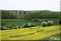

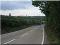
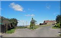
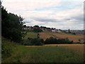
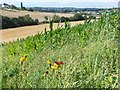
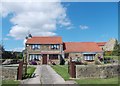
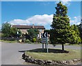

9 photos from this area
Area Information
Key information about the S65 3QQ including its size, population, and administrative classification.
- Area Type
- Postcode
- Area Size
- 10.7 hectares
- Population
- 1415
- Population Density
- 635 people/km²
House Prices in S65 3QQ
8
Properties
£221,400
Average Sold Price
£55,000
Lowest Price
£460,200
Highest Price
Showing 8 properties
| Address | Type | Beds | Baths | Last Sale Price | Last Sale Date | |
|---|---|---|---|---|---|---|
| Dene Brook, Former Dene Brook Hotel, Dalton Lane, Dalton, Rotherham, S65 3QQ | hospital_care_home | - | - | £460,200 | Sep 2003 | |
| Dene Cottage, Dalton Lane, Dalton, Rotherham, S65 3QQ | Semi-detached | - | - | £149,000 | Mar 2002 | |
| School House, Dalton Lane, Dalton, Rotherham, S65 3QQ | Detached | - | - | £55,000 | Sep 1998 | |
| Dalbreck House, Dalton Lane, Dalton, Rotherham, S65 3QQ | Detached | - | - | - | - | |
| Manor Farm, Dalton Lane, Dalton, Rotherham, S65 3QQ | Detached | - | - | - | - | |
| Brook Cottage, Dalton Lane, Dalton, Rotherham, S65 3QQ | Semi-detached | - | - | - | - | |
| Manor Farm House, Dalton Lane, Dalton, Rotherham, S65 3QQ | Semi-detached | - | - | - | - | |
| Millstone Barn, Dalton Lane, Dalton, Rotherham, S65 3QQ | Detached | - | - | - | - |
Energy Efficiency in S65 3QQ
Amenities
Schools
| Rank | School | Type | Entry gender | Ages |
|---|
Explore more schools in this area
Go to Schools tabDemographics
Household Size
Two person
most common
Accommodation Type
Houses
most common
Tenure
68
majority
Ethnic Group
White
most common
Religion
N/A
most common
Household Composition
N/A
most common
Age
47
median
Adults (30-64 years)
most common
Household Deprivation
N/A
with no deprivation
NS-SEC
37
in Lower managerial occupations
Explore more demographic insights in this area
Go to Demographics tabPlanning
Planning Constraints
- Flood RiskPremium
- Ramsar Wetland SitesPremium
- Area of Outstanding Natural BeautyPremium
- Protected Nature ReservePremium
- Protected WoodlandPremium