Area Overview for S65 3ER
Photos of S65 3ER

Area Information
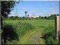
Living in S65 3ER means residing in a specific residential cluster characterised by high density and a clear residential purpose. This postcode covers a small area where the population reaches 1,639 people, creating a community with a population density of 1,101 people per square kilometre. Such figures indicate a built environment where immediate neighbours are rarely far away. The setting is firmly established as a housing estate rather than a sprawling suburb, which defines the rhythm of daily life for residents. You will find no industrial zones or major arterial roads cutting through this specific grid, allowing the area to function as a dedicated living space. The scale of the district is modest, yet the concentration of homes ensures that local services operate within a defined loop rather than stretching indefinitely. For those seeking a home in S65 3ER, the reality is a compact neighbourhood where every street contributes to the total housing count. This singularity in structure means that community interactions often happen at intersections or along shared walkways. The area stands as a distinct entity within the wider Doncaster and Rotherham corridor, prioritising residence over mixed commercial use. You should expect a straightforward environment where the primary focus remains on housing stock rather than commercial expansion.
- Area Type
- Postcode
- Area Size
- Not available
- Population
- 1639
- Population Density
- 1101 people/km²
The property market in S65 3ER is defined by a substantial stock of houses, which aligns closely with the 45 per cent home ownership rate observed in the area. This specific postcode functions as a small residential cluster, meaning the total number of properties available for purchase or rent is limited compared to larger municipal districts. You are looking at a mix of owner-occupied homes and rental properties, though the significant ownership percentage indicates a strong market for buying rather than a purely transient rental sector. Since the area consists almost entirely of houses, buyers will find accommodation suited to families needing traditional layouts with gardens. There are no listed flats or apartments within the S65 3ER definition, which simplifies the search process for those who prefer single-story or detached housing. The small population of 1,639 people implies a limited inventory, so competition among buyers in this specific cluster can be intense despite the lower total volume. When considering homes in S65 3ER, you must act quickly because the supply is constrained by the small geographical footprint of the postcode. The 1,101 population density further confirms that space is at a premium, which often drives up average prices relative to nearby suburban areas with more land.
House Prices in S65 3ER
No properties found in this postcode.
Energy Efficiency in S65 3ER
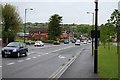
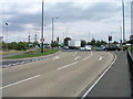
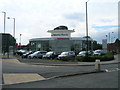
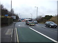
Your daily life in S65 3ER is supported by a ring of practical amenities located within easy reach of the residential cluster. Retail options are well catered for with five major supermarkets serving the local population, including Lidl Doncaster, Asda Rotherham, and Iceland Sycamore. These venues allow you to carry out all essential shopping tasks without travelling far beyond your immediate neighbourhood. For transport, five metro stops facilitate local connectivity, with Parkgate and Rotherham Platform Both Directions offering convenient access to nearby hubs. Rail travel is equally accessible through Rotherham Central Railway Station, Swinton Railway Station, and Mexborough Railway Station. These stations connect residents to wider regional networks, linking the small postcode area to the broader South Yorkshire infrastructure. You have five metro links and five railway points to choose from, ensuring flexibility if you need to commute or travel for leisure. The combination of large grocery chains and multiple transport nodes creates a supportive environment where daily needs are met efficiently. Living in S65 3ER means you can access significant commercial and transport hubs while remaining in a quiet residential setting.
Amenities
Schools
Families living in S65 3ER benefit from immediate access to four primary schools, all of which serve the local catchment or wider community. Dalton Foljambe Primary School operates as a primary institution for young learners in the vicinity. Trinity Croft CofE Junior and Infant School offers a mixed primary option focusing on faith-based education. Trinity Croft CofE Primary Academy also falls under the primary category, providing another choice for families in the area. Finally, Foljambe Primary School completes the list of nearby educational facilities within walking or short driving distance. All four institutions are rated as primary schools, indicating a focus on early childhood and secondary education rather than post-16 provisions. The concentration of primary schools near S65 3ER suggests that the area caters heavily to young children and their parents. There are no secondary schools listed in the data for this specific proximity, meaning older students in the most common age range of 30 to 64 would typically travel to schools further away. The presence of multiple primary options provides residents with choices between different educational philosophies and community styles within a short radius.
| Rank | School | Type | Entry gender | Ages |
|---|
Explore more schools in this area
Go to Schools tabDemographics
The community in S65 3ER reflects a mature demographic profile with a median age of 47 years. Adults between 30 and 64 years represent the most common age range, suggesting a neighbourhood occupied primarily by established families and individuals on mid-stage careers. Home ownership stands at 45 per cent, creating a balanced market where nearly half of the residents own their property outright or via mortgage. The remaining households likely include long-term renters or those in the early stages of property acquisition. Houses form the predominant accommodation type, confirming that the area is built for traditional family living rather than high-density flats or purpose-built apartments. The ethnic composition is predominantly White, which aligns with the broader regional trends found in much of South Yorkshire. Deprivation data is not included in the assessment of this specific postcode, so quality of life indicators must be inferred from the age and ownership patterns. The stability indicated by the 45 per cent ownership rate suggests a settled population with likely long-term tenure. You will encounter a demographic that values stability, as evidenced by the high proportion of adults over thirty. This age profile often correlates with lower household formation rates compared to university towns, resulting in a quieter, more settled atmosphere.
Household Size
Accommodation Type
Tenure
Ethnic Group
Religion
Household Composition
Age
Household Deprivation
NS-SEC
Explore more demographic insights in this area
Go to Demographics tabPlanning
Planning Constraints
- Flood RiskPremium
- Ramsar Wetland SitesPremium
- Area of Outstanding Natural BeautyPremium
- Protected Nature ReservePremium
- Protected WoodlandPremium