Area Overview for S65 2SR
Photos of S65 2SR
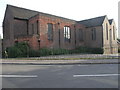
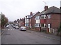
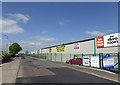
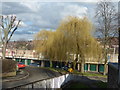
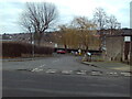
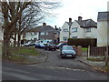
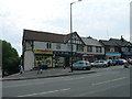
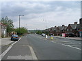
13 photos from this area
Area Information
Key information about the S65 2SR including its size, population, and administrative classification.
- Area Type
- Postcode
- Area Size
- 1.7 hectares
- Population
- 1395
- Population Density
- 7202 people/km²
House Prices in S65 2SR
48
Properties
£70,724
Average Sold Price
£24,000
Lowest Price
£128,500
Highest Price
Showing 48 properties
| Address | Type | Beds | Baths | Last Sale Price | Last Sale Date | |
|---|---|---|---|---|---|---|
| 29 Queen Street, Clifton, Rotherham, S65 2SR | Terraced | 2 | 1 | £90,000 | May 2025 | |
| 52 Queen Street, Clifton, Rotherham, S65 2SR | Terraced | 2 | - | £90,000 | Aug 2023 | |
| 51 Queen Street, Clifton, Rotherham, S65 2SR | Terraced | 2 | 1 | £85,000 | Oct 2022 | |
| 48 Queen Street, Clifton, Rotherham, S65 2SR | Terraced | 2 | 1 | £79,000 | Oct 2022 | |
| 38 Queen Street, Clifton, Rotherham, S65 2SR | Terraced | 2 | 1 | £99,000 | Sep 2022 | |
| 30 Queen Street, Clifton, Rotherham, S65 2SR | house | - | - | £95,000 | Apr 2022 | |
| 33 Queen Street, Clifton, Rotherham, S65 2SR | Terraced | 2 | 1 | £92,500 | Mar 2022 | |
| 31 Queen Street, Clifton, Rotherham, S65 2SR | house | - | - | £83,000 | Jun 2021 | |
| 39 Queen Street, Clifton, Rotherham, S65 2SR | Terraced | 2 | 1 | £85,000 | Mar 2021 | |
| 47 Queen Street, Clifton, Rotherham, S65 2SR | Terraced | 2 | 1 | £70,000 | Sep 2019 |
Page 1 of 5
Energy Efficiency in S65 2SR
Amenities
Schools
| Rank | School | Type | Entry gender | Ages |
|---|
Explore more schools in this area
Go to Schools tabDemographics
Household Size
Two person
most common
Accommodation Type
Houses
most common
Tenure
61
majority
Ethnic Group
White
most common
Religion
N/A
most common
Household Composition
N/A
most common
Age
47
median
Adults (30-64 years)
most common
Household Deprivation
N/A
with no deprivation
NS-SEC
18
in Lower managerial occupations
Explore more demographic insights in this area
Go to Demographics tabPlanning
Planning Constraints
- Flood RiskPremium
- Ramsar Wetland SitesPremium
- Area of Outstanding Natural BeautyPremium
- Protected Nature ReservePremium
- Protected WoodlandPremium