Area Overview for S65 2QR
Photos of S65 2QR


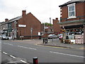

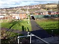
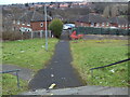
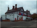

19 photos from this area
Area Information
Key information about the S65 2QR including its size, population, and administrative classification.
- Area Type
- Postcode
- Area Size
- 6141 m²
- Population
- 1431
- Population Density
- 2649 people/km²
House Prices in S65 2QR
8
Properties
£65,363
Average Sold Price
£24,500
Lowest Price
£91,000
Highest Price
Showing 8 properties
| Address | Type | Beds | Baths | Last Sale Price | Last Sale Date | |
|---|---|---|---|---|---|---|
| 300 Badsley Moor Lane, Herringthorpe, Rotherham, S65 2QR | Semi-detached | 3 | 2 | £91,000 | Aug 2006 | |
| 302 Badsley Moor Lane, Herringthorpe, Rotherham, S65 2QR | house | - | - | £80,000 | Sep 2005 | |
| 306 Badsley Moor Lane, Herringthorpe, Rotherham, S65 2QR | Terraced | - | - | £65,950 | Sep 2004 | |
| 497A Badsley Moor Lane, Herringthorpe, Rotherham, S65 2QR | Flat | - | - | £24,500 | Mar 1997 | |
| Flat, 493 Badsley Moor Lane, Clifton, Rotherham, S65 2QR | retail_financial | - | - | - | - | |
| 495A Badsley Moor Lane, Herringthorpe, Rotherham, S65 2QR | Retail | - | - | - | - | |
| 304 Badsley Moor Lane, Herringthorpe, Rotherham, S65 2QR | Terraced | - | - | - | - | |
| Flat Over, 491 Badsley Moor Lane, Herringthorpe, Rotherham, S65 2QR | Flat | - | - | - | - |
Energy Efficiency in S65 2QR
Amenities
Schools
| Rank | School | Type | Entry gender | Ages |
|---|
Explore more schools in this area
Go to Schools tabDemographics
Household Size
Family (3-5 people)
most common
Accommodation Type
Houses
most common
Tenure
33
majority
Ethnic Group
White
most common
Religion
N/A
most common
Household Composition
N/A
most common
Age
47
median
Adults (30-64 years)
most common
Household Deprivation
N/A
with no deprivation
NS-SEC
11
in Lower managerial occupations
Explore more demographic insights in this area
Go to Demographics tabPlanning
Planning Constraints
- Flood RiskPremium
- Ramsar Wetland SitesPremium
- Area of Outstanding Natural BeautyPremium
- Protected Nature ReservePremium
- Protected WoodlandPremium