Area Overview for S65 2NN
Photos of S65 2NN


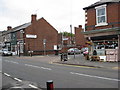
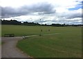
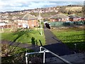
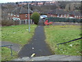
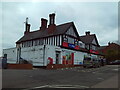
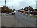
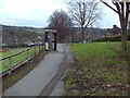
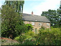
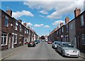
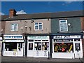
19 photos from this area
Area Information
Key information about the S65 2NN including its size, population, and administrative classification.
- Area Type
- Postcode
- Area Size
- 2968 m²
- Population
- 1737
- Population Density
- 6458 people/km²
House Prices in S65 2NN
10
Properties
£72,750
Average Sold Price
£32,500
Lowest Price
£115,000
Highest Price
Showing 10 properties
| Address | Type | Beds | Baths | Last Sale Price | Last Sale Date | |
|---|---|---|---|---|---|---|
| 65 Browning Road, Herringthorpe, Rotherham, S65 2NN | house | 3 | - | £115,000 | Apr 2021 | |
| 73 Browning Road, Herringthorpe, Rotherham, S65 2NN | house | - | - | £91,000 | Apr 2019 | |
| 75 Browning Road, Herringthorpe, Rotherham, S65 2NN | Semi-detached | 2 | 1 | £70,000 | Nov 2017 | |
| 83 Browning Road, Herringthorpe, Rotherham, S65 2NN | Detached | 3 | 1 | £89,000 | Apr 2005 | |
| 77 Browning Road, Herringthorpe, Rotherham, S65 2NN | house | - | - | £39,000 | Sep 2002 | |
| 81 Browning Road, Herringthorpe, Rotherham, S65 2NN | Semi-detached | - | - | £32,500 | Oct 2000 | |
| 67 Browning Road, Herringthorpe, Rotherham, S65 2NN | Semi-detached | 2 | 1 | - | - | |
| 79 Browning Road, Herringthorpe, Rotherham, S65 2NN | Semi-detached | - | - | - | - | |
| 69 Browning Road, Herringthorpe, Rotherham, S65 2NN | Semi-detached | - | - | - | - | |
| 71 Browning Road, Herringthorpe, Rotherham, S65 2NN | house | - | - | - | - |
Energy Efficiency in S65 2NN
Amenities
Schools
| Rank | School | Type | Entry gender | Ages |
|---|
Explore more schools in this area
Go to Schools tabDemographics
Household Size
One person
most common
Accommodation Type
Houses
most common
Tenure
37
majority
Ethnic Group
White
most common
Religion
N/A
most common
Household Composition
N/A
most common
Age
47
median
Adults (30-64 years)
most common
Household Deprivation
N/A
with no deprivation
NS-SEC
11
in Lower managerial occupations
Explore more demographic insights in this area
Go to Demographics tabPlanning
Planning Constraints
- Flood RiskPremium
- Ramsar Wetland SitesPremium
- Area of Outstanding Natural BeautyPremium
- Protected Nature ReservePremium
- Protected WoodlandPremium