Area Overview for S65 2LU
Photos of S65 2LU
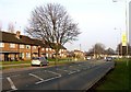
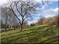
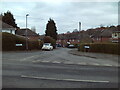
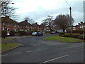
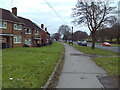
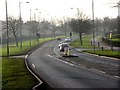
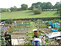
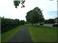
13 photos from this area
Area Information
Key information about the S65 2LU including its size, population, and administrative classification.
- Area Type
- Postcode
- Area Size
- 8373 m²
- Population
- 1431
- Population Density
- 2649 people/km²
House Prices in S65 2LU
17
Properties
£84,250
Average Sold Price
£35,000
Lowest Price
£175,050
Highest Price
Showing 17 properties
| Address | Type | Beds | Baths | Last Sale Price | Last Sale Date | |
|---|---|---|---|---|---|---|
| 156 Tennyson Road, Herringthorpe, Rotherham, S65 2LU | Semi-detached | 3 | 1 | £175,050 | Nov 2024 | |
| 151 Tennyson Road, Herringthorpe, Rotherham, S65 2LU | Semi-detached | 2 | 1 | £111,000 | Feb 2022 | |
| 148 Tennyson Road, Herringthorpe, Rotherham, S65 2LU | Semi-detached | 2 | 1 | £77,500 | Jul 2019 | |
| 143 Tennyson Road, Herringthorpe, Rotherham, S65 2LU | Semi-detached | 2 | - | £65,000 | Jun 2013 | |
| 158 Tennyson Road, Herringthorpe, Rotherham, S65 2LU | Semi-detached | - | - | £41,950 | Feb 2003 | |
| 145 Tennyson Road, Herringthorpe, Rotherham, S65 2LU | Semi-detached | - | - | £35,000 | Nov 2002 | |
| 147 Tennyson Road, Herringthorpe, Rotherham, S65 2LU | Semi-detached | - | - | - | - | |
| 149 Tennyson Road, Herringthorpe, Rotherham, S65 2LU | Semi-detached | - | - | - | - | |
| 154 Tennyson Road, Herringthorpe, Rotherham, S65 2LU | house | - | - | - | - | |
| 142 Tennyson Road, Herringthorpe, Rotherham, S65 2LU | Semi-detached | - | - | - | - |
Page 1 of 2
Energy Efficiency in S65 2LU
Amenities
Schools
| Rank | School | Type | Entry gender | Ages |
|---|
Explore more schools in this area
Go to Schools tabDemographics
Household Size
Family (3-5 people)
most common
Accommodation Type
Houses
most common
Tenure
33
majority
Ethnic Group
White
most common
Religion
N/A
most common
Household Composition
N/A
most common
Age
47
median
Adults (30-64 years)
most common
Household Deprivation
N/A
with no deprivation
NS-SEC
11
in Lower managerial occupations
Explore more demographic insights in this area
Go to Demographics tabPlanning
Planning Constraints
- Flood RiskPremium
- Ramsar Wetland SitesPremium
- Area of Outstanding Natural BeautyPremium
- Protected Nature ReservePremium
- Protected WoodlandPremium