Area Overview for S65 2LL
Photos of S65 2LL


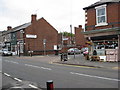
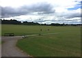
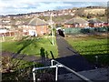
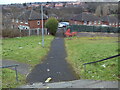
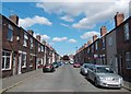
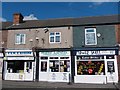
19 photos from this area
Area Information
Key information about the S65 2LL including its size, population, and administrative classification.
- Area Type
- Postcode
- Area Size
- 1.8 hectares
- Population
- 1737
- Population Density
- 6458 people/km²
House Prices in S65 2LL
75
Properties
£72,535
Average Sold Price
£15,067
Lowest Price
£100,000
Highest Price
Showing 75 properties
| Address | Type | Beds | Baths | Last Sale Price | Last Sale Date | |
|---|---|---|---|---|---|---|
| 104 Longfellow Drive, Herringthorpe, Rotherham, S65 2LL | house | - | - | £100,000 | Sep 2025 | |
| 88 Longfellow Drive, Herringthorpe, Rotherham, S65 2LL | Terraced | 2 | 1 | £56,000 | Dec 2019 | |
| 70 Longfellow Drive, Herringthorpe, Rotherham, S65 2LL | house | - | - | £77,500 | Jan 2015 | |
| 76 Longfellow Drive, Herringthorpe, Rotherham, S65 2LL | Terraced | 3 | 2 | £80,000 | Mar 2012 | |
| 68 Longfellow Drive, Herringthorpe, Rotherham, S65 2LL | house | 3 | - | £81,000 | May 2011 | |
| 140 Longfellow Drive, Herringthorpe, Rotherham, S65 2LL | Terraced | - | - | £92,000 | Jan 2008 | |
| 148 Longfellow Drive, Herringthorpe, Rotherham, S65 2LL | house | - | - | £84,000 | Nov 2007 | |
| 128 Longfellow Drive, Herringthorpe, Rotherham, S65 2LL | Semi-detached | 3 | - | £67,250 | Apr 2004 | |
| 78 Longfellow Drive, Herringthorpe, Rotherham, S65 2LL | Terraced | - | - | £15,067 | Feb 2004 | |
| 24 Longfellow Drive, Herringthorpe, Rotherham, S65 2LL | Flat | - | - | - | - |
Page 1 of 8
Energy Efficiency in S65 2LL
Amenities
Schools
| Rank | School | Type | Entry gender | Ages |
|---|
Explore more schools in this area
Go to Schools tabDemographics
Household Size
One person
most common
Accommodation Type
Houses
most common
Tenure
37
majority
Ethnic Group
White
most common
Religion
N/A
most common
Household Composition
N/A
most common
Age
47
median
Adults (30-64 years)
most common
Household Deprivation
N/A
with no deprivation
NS-SEC
11
in Lower managerial occupations
Explore more demographic insights in this area
Go to Demographics tabPlanning
Planning Constraints
- Flood RiskPremium
- Ramsar Wetland SitesPremium
- Area of Outstanding Natural BeautyPremium
- Protected Nature ReservePremium
- Protected WoodlandPremium