Area Overview for S65 2HE
Photos of S65 2HE

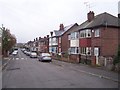

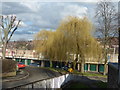
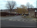
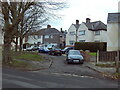


13 photos from this area
Area Information
Key information about the S65 2HE including its size, population, and administrative classification.
- Area Type
- Postcode
- Area Size
- 7771 m²
- Population
- 1461
- Population Density
- 6419 people/km²
House Prices in S65 2HE
16
Properties
£80,582
Average Sold Price
£18,240
Lowest Price
£113,500
Highest Price
Showing 16 properties
| Address | Type | Beds | Baths | Last Sale Price | Last Sale Date | |
|---|---|---|---|---|---|---|
| 32 Chestnut Avenue, East Dene, Rotherham, S65 2HE | Semi-detached | 2 | 1 | £113,500 | Dec 2019 | |
| 34 Chestnut Avenue, East Dene, Rotherham, S65 2HE | Semi-detached | 3 | 1 | £110,000 | Aug 2019 | |
| 28 Chestnut Avenue, East Dene, Rotherham, S65 2HE | Semi-detached | 3 | - | £81,500 | Oct 2017 | |
| 40 Chestnut Avenue, East Dene, Rotherham, S65 2HE | house | 3 | - | £77,000 | May 2015 | |
| 42 Chestnut Avenue, East Dene, Rotherham, S65 2HE | Semi-detached | 3 | - | £72,500 | Sep 2009 | |
| 36 Chestnut Avenue, East Dene, Rotherham, S65 2HE | house | - | - | £65,000 | Jun 2009 | |
| 23 Chestnut Avenue, East Dene, Rotherham, S65 2HE | house | - | - | £92,500 | May 2006 | |
| 22 Chestnut Avenue, East Dene, Rotherham, S65 2HE | house | - | - | £94,995 | Sep 2005 | |
| 17 Chestnut Avenue, East Dene, Rotherham, S65 2HE | Terraced | - | - | £18,240 | Dec 1997 | |
| 30 Chestnut Avenue, East Dene, Rotherham, S65 2HE | Semi-detached | - | - | - | - |
Page 1 of 2
Energy Efficiency in S65 2HE
Amenities
Schools
| Rank | School | Type | Entry gender | Ages |
|---|
Explore more schools in this area
Go to Schools tabDemographics
Household Size
Family (3-5 people)
most common
Accommodation Type
Houses
most common
Tenure
51
majority
Ethnic Group
White
most common
Religion
N/A
most common
Household Composition
N/A
most common
Age
47
median
Adults (30-64 years)
most common
Household Deprivation
N/A
with no deprivation
NS-SEC
11
in Lower managerial occupations
Explore more demographic insights in this area
Go to Demographics tabPlanning
Planning Constraints
- Flood RiskPremium
- Ramsar Wetland SitesPremium
- Area of Outstanding Natural BeautyPremium
- Protected Nature ReservePremium
- Protected WoodlandPremium