Area Overview for S65 1YH
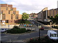
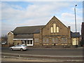
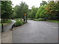
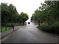
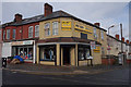
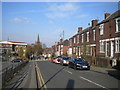
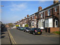
Photos of S65 1YH


Area Information
S65 1YH represents a specific residential cluster within the S65 postcode area of England. This location serves exactly 1,995 residents, creating a small, tightly knit community. The area is defined by its residential nature, offering a quiet environment away from the larger noise of the city centre. Daily life here revolves around proximity to key transport hubs and local retail centres rather than major urban sprawl. You are looking at a established neighbourhood where the focus remains on housing and immediate local convenience. The population density allows for a sense of familiarity among neighbours, suitable for those seeking a contained living space. This small geographic footprint means that amenities are within practical reach without requiring long commutes. The setting offers a straightforward living experience for those who prefer a defined residential zone over a sprawling landscape. Understand that this is a compact area, and your exploration should focus on the immediate surroundings and local connections.
- Area Type
- Postcode
- Area Size
- Not available
- Population
- 1995
- Population Density
- 5432 people/km²
The property market in S65 1YH is heavily influenced by the fact that houses serve as the primary accommodation type. With home ownership standing at 35%, the area presents a mix of owner-occupied stocks and potential rental opportunities. This lower ownership rate compared to rural areas suggests a dynamic environment where leasing might play a significant role in housing decisions. Buyers looking at this small postcode area will find that the housing stock is largely composed of houses, providing a distinct feel from urban flats. The market size is constrained by the total population of 1,995, which limits the sheer volume of homes available at any given time. You might find that competition for properties is less intense than in larger boroughs, but the choice is also more limited. The prevalence of house ownership means maintenance costs and property upkeep are relevant considerations for prospective buyers. The area does not offer a vast range of property styles, focusing instead on the traditional house model found throughout the S65 postcode district.
House Prices in S65 1YH
No properties found in this postcode.
Energy Efficiency in S65 1YH
Residents of S65 1YH benefit from a practical range of amenities located within practical reach. Five retail outlets are nearby, including Farmfoods Rotherham, Tesco Rotherham, and Heron East, ensuring access to groceries and daily essentials. For those needing alternative transport, five metro options are available, such as Parkgate, Rotherham Platform Both Directions, and Meadowhall South. Five rail stations provide further connectivity, with notable stops including Rotherham Central Railway Station, Meadowhall Railway Station, and Medowhall Railway Station. These transport links allow you to travel to major employment centres and leisure destinations quickly. The presence of multiple station names suggests a well-networked rail hub close to the postcode area. You do not need to travel far to stock up on goods or catch a train outside of the immediate area. The local retail and transport infrastructure provides a convenient lifestyle without the need for extensive private transport.
Amenities
Schools
Families considering S65 1YH have access to several primary education options within the vicinity. St Ann's Junior School offers primary education to local children, while St Ann's Junior and Infant School provides a split stage primary setup. St Ann's Primary School also holds a Good Ofsted rating, indicating a standard of education that meets national expectations. Similarly, Eastwood Village Primary School carries a Good Ofsted rating, giving parents a choice between two highly-rated institutions for their children. St Ann's Primary School receives the same positive Ofsted designation, reinforcing the local choice of quality early education. You will find no secondary schools listed in the immediate proximity, meaning children will likely travel further for upper secondary education. The concentration of primary schools with Good ratings suggests a reliable local education sector for young children. These institutions form the backbone of community support for families residing in the S65 1YH postcode area.
| Rank | School | Type | Entry gender | Ages |
|---|
Explore more schools in this area
Go to Schools tabDemographics
The community in S65 1YH is characterised by a mature demographic profile with a median age of 47. Most residents fall into the adults category between 30 and 64 years old, suggesting a neighbourhood dominated by established households. Home ownership accounts for 35% of the population, indicating that a significant portion of residents live in privately owned properties. The remaining occupants likely reside in rented accommodation, though the specific breakdown is not detailed in the available figures. Houses form the predominant accommodation type, meaning the architectural landscape consists mainly of detached or semi-detached structures rather than high-rise flats. The population is predominantly White, reflecting the broader ethnic composition common in many parts of the region. This age profile suggests stability, with fewer young families moving in compared to younger postcodes. You should expect a community where long-term residents make up the bulk of the social fabric. The lack of younger children in the median age range may impact the daily bustle of the streets compared to areas with many school-aged families.
Household Size
Accommodation Type
Tenure
Ethnic Group
Religion
Household Composition
Age
Household Deprivation
NS-SEC
Explore more demographic insights in this area
Go to Demographics tabPlanning
Planning Constraints
- Flood RiskPremium
- Ramsar Wetland SitesPremium
- Area of Outstanding Natural BeautyPremium
- Protected Nature ReservePremium
- Protected WoodlandPremium