Area Overview for S65 1NA
Photos of S65 1NA

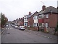
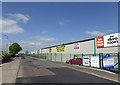

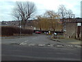
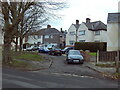
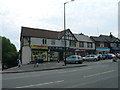
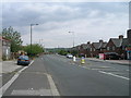
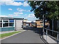

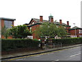
13 photos from this area
Area Information
Key information about the S65 1NA including its size, population, and administrative classification.
- Area Type
- Postcode
- Area Size
- 1.1 hectares
- Population
- 1634
- Population Density
- 1277 people/km²
House Prices in S65 1NA
42
Properties
£66,444
Average Sold Price
£36,000
Lowest Price
£110,000
Highest Price
Showing 42 properties
| Address | Type | Beds | Baths | Last Sale Price | Last Sale Date | |
|---|---|---|---|---|---|---|
| 283 Fitzwilliam Road, Eastwood, Rotherham, S65 1NA | Semi-detached | 2 | 1 | £95,000 | Jul 2023 | |
| 273 Fitzwilliam Road, Eastwood, Rotherham, S65 1NA | house | - | - | £110,000 | Sep 2022 | |
| 443 Fitzwilliam Road, Eastwood, Rotherham, S65 1NA | Terraced | 2 | 1 | £36,000 | Jan 2019 | |
| 441 Fitzwilliam Road, Eastwood, Rotherham, S65 1NA | Terraced | 2 | 1 | £48,000 | Dec 2018 | |
| 445 Fitzwilliam Road, Eastwood, Rotherham, S65 1NA | Terraced | 2 | 1 | £38,000 | Nov 2017 | |
| 265 Fitzwilliam Road, Eastwood, Rotherham, S65 1NA | house | 2 | - | £69,500 | Mar 2012 | |
| 263 Fitzwilliam Road, Eastwood, Rotherham, S65 1NA | Semi-detached | - | - | £78,000 | Aug 2008 | |
| 275 Fitzwilliam Road, Eastwood, Rotherham, S65 1NA | house | - | - | £73,500 | Dec 2007 | |
| 277 Fitzwilliam Road, Eastwood, Rotherham, S65 1NA | Semi-detached | - | - | £50,000 | Sep 2004 | |
| 449B Fitzwilliam Road, Eastwood, Rotherham, S65 1NA | Terraced | 2 | 2 | - | - |
Page 1 of 5
Energy Efficiency in S65 1NA
Amenities
Schools
| Rank | School | Type | Entry gender | Ages |
|---|
Explore more schools in this area
Go to Schools tabDemographics
Household Size
One person
most common
Accommodation Type
Houses
most common
Tenure
30
majority
Ethnic Group
White
most common
Religion
N/A
most common
Household Composition
N/A
most common
Age
47
median
Adults (30-64 years)
most common
Household Deprivation
N/A
with no deprivation
NS-SEC
9
in Lower managerial occupations
Explore more demographic insights in this area
Go to Demographics tabPlanning
Planning Constraints
- Flood RiskPremium
- Ramsar Wetland SitesPremium
- Area of Outstanding Natural BeautyPremium
- Protected Nature ReservePremium
- Protected WoodlandPremium