Area Overview for S65 1DD
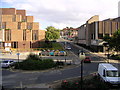
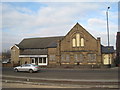
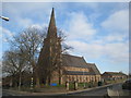
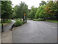
Photos of S65 1DD

Area Information
Living in S65 1DD means residing within a compact residential cluster defined by postcode S65 1DD. This specific area in England accommodates a population of 2,249 people across a small footprint, resulting in a high density of 1,483 people per square kilometre. The environment is tightly packed, creating a neighbourhood where residents are in close proximity to one another. Daily life here revolves around immediate access to local services rather than sprawling suburbs. The area functions as a distinct residential unit, separate from the wider borough context, yet fully integrated into the surrounding transport and retail networks. You will find a community where space is valued for efficiency, and convenience is achieved through density. Homes here are situated within easy reach of major transport links and essential shopping facilities. The character of S65 1DD is shaped by its function as a high-density living zone, prioritising accessibility over spaciousness. For anyone considering moving to this postcode, understanding the compact nature of the area is essential for managing expectations about privacy and estate size. The layout supports an active lifestyle where amenities are rarely far from your front door.
- Area Type
- Postcode
- Area Size
- Not available
- Population
- 2249
- Population Density
- 1483 people/km²
The property market in S65 1DD is defined by a predominantly rental sector rather than owner-occupied stock. With home ownership levels at 19%, you will find that most homes are let properties available for rent. This dynamic shapes the availability and pricing of accommodation throughout the postcode. The predominant accommodation type in the area consists of flats, reflecting the high-density character of the residential cluster. These flats are designed for urban living, offering multiple units close together to accommodate the population of 2,249 residents within a small footprint. If you are looking to buy, options may be limited compared to dedicated suburban housing estates, necessitating closer inspection of available rental conversions or older conversion blocks. The market is well-suited to tenants, investors, and younger professionals who prefer the flexibility of renting over the commitment of purchasing. The density of 1,483 people per square kilometre ensures that these flats are in constant demand. For buyers, understanding this high rental ratio means considering long-term tenure or viewing properties outside the immediate S65 1DD radius if primary ownership is your goal. The housing stock is functional and efficient, prioritising space usage over large individual plots.
House Prices in S65 1DD
No properties found in this postcode.
Energy Efficiency in S65 1DD
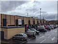
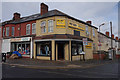
Residents of S65 1DD enjoy immediate access to a range of retail and transport hubs. Five major retail locations are within practical reach, including Tesco Rotherham, Heron Rotherham, and Morrisons Daily. These supermarkets provide comprehensive grocery shopping options for your weekly needs. Transport links are extensive, with five metro options and five rail stations nearby. Key transport nodes include Rotherham Platform, Meadowhall South, Rotherham Central Railway Station, and Meadowhall Railway Station. These stations facilitate easy travel to Sheffield, Manchester, and other major UK cities. Daily commuting is straightforward, as you can reach the Parkgate and Meadowhall interchange points quickly. Shopping does not require a long journey, as stores like Heron Rotherham handle specific needs efficiently. The concentration of amenities within close distance supports a convenient lifestyle where essential errands are completed efficiently. You can rely on this network for regular travel and shopping. The proximity of TESCO and MORRISONs Daily means price comparing is easy and fuel costs are minimised. Living in S65 1DD prioritises accessibility to these established commercial and transport landmarks.
Amenities
Schools
Families residing in S65 1DD have access to a limited but specific selection of educational institutions. The nearest educational facility is RNN Group, a sixth-form college. This institution caters to older students preparing for university entry or further vocational training, rather than primary or secondary education. The absence of primary and secondary school data in the immediate vicinity means residents likely rely on institutions outside the immediate postcode boundary for younger children. The presence of a sixth-form college suggests that mature students may live nearby, often studying part-time or evening classes alongside work. For parents, this means there is no attached primary or secondary school within the defined area data. You must look further afield for comprehensive schooling for younger children, such as primary schools in adjacent districts. The educational offer is therefore niche, focussing on the senior stages of the school journey. If a full range of schooling is a priority, you will need to verify catchment areas in neighbouring zones. RNN Group remains the primary named option available directly to the S65 1DD population.
| Rank | School | Type | Entry gender | Ages |
|---|
Explore more schools in this area
Go to Schools tabDemographics
The community within S65 1DD is dominated by adults aged between 30 and 64 years. This age range represents the most common demographic group in the area, reflecting a mature population with established lives. The median age stands at 47 years, confirming that younger households and empty nesters form the core of the resident base. Home ownership is relatively low, with only 19% of residents owning their properties outright. This indicates that the majority of people in S65 1DD rent their accommodation rather than own it. Consequently, the housing stock consists primarily of privately rented units or social housing, rather than owner-occupied family homes. The predominant ethnic group in the area is White, which aligns with broader national trends for this specific postcode sector. Density plays a significant role in daily life, with 1,483 people living in every square kilometre. This high concentration of residents creates a lively local atmosphere where community interactions happen frequently. The demographic profile suggests an area suitable for mid-life individuals and families seeking an established environment rather than a changing new-build development.
Household Size
Accommodation Type
Tenure
Ethnic Group
Religion
Household Composition
Age
Household Deprivation
NS-SEC
Explore more demographic insights in this area
Go to Demographics tabPlanning
Planning Constraints
- Flood RiskPremium
- Ramsar Wetland SitesPremium
- Area of Outstanding Natural BeautyPremium
- Protected Nature ReservePremium
- Protected WoodlandPremium