Area Overview for S64 8HH
Photos of S64 8HH
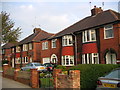
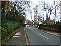
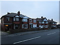

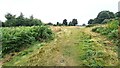
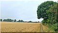
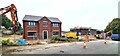
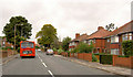
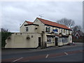
16 photos from this area
Area Information
Key information about the S64 8HH including its size, population, and administrative classification.
- Area Type
- Postcode
- Area Size
- 1.7 hectares
- Population
- 1460
- Population Density
- 3233 people/km²
House Prices in S64 8HH
44
Properties
£106,300
Average Sold Price
£19,655
Lowest Price
£155,000
Highest Price
Showing 44 properties
| Address | Type | Beds | Baths | Last Sale Price | Last Sale Date | |
|---|---|---|---|---|---|---|
| 70 Toll Bar Road, Swinton, Rotherham, S64 8HH | Semi-detached | 3 | 1 | £155,000 | Jul 2024 | |
| 80 Toll Bar Road, Swinton, Rotherham, S64 8HH | Semi-detached | 3 | 1 | £140,000 | Feb 2024 | |
| 53 Toll Bar Road, Swinton, Rotherham, S64 8HH | Semi-detached | 3 | 2 | £137,000 | Mar 2023 | |
| 72 Toll Bar Road, Swinton, Rotherham, S64 8HH | Semi-detached | 3 | 1 | £140,000 | Nov 2022 | |
| 65 Toll Bar Road, Swinton, Rotherham, S64 8HH | Detached | 3 | 1 | £125,000 | Oct 2021 | |
| 55 Toll Bar Road, Swinton, Rotherham, S64 8HH | house | - | - | £133,500 | Mar 2021 | |
| 66 Toll Bar Road, Swinton, Rotherham, S64 8HH | Semi-detached | 3 | 1 | £125,000 | Mar 2020 | |
| 45 Toll Bar Road, Swinton, Rotherham, S64 8HH | Semi-detached | 3 | 1 | £101,815 | Jan 2019 | |
| 48 Toll Bar Road, Swinton, Rotherham, S64 8HH | Semi-detached | 3 | 1 | £118,500 | Jul 2017 | |
| 67 Toll Bar Road, Swinton, Rotherham, S64 8HH | Semi-detached | 3 | 1 | £103,000 | Mar 2017 |
Page 1 of 5
Energy Efficiency in S64 8HH
Amenities
Schools
| Rank | School | Type | Entry gender | Ages |
|---|
Explore more schools in this area
Go to Schools tabDemographics
Household Size
Two person
most common
Accommodation Type
Houses
most common
Tenure
58
majority
Ethnic Group
White
most common
Religion
N/A
most common
Household Composition
N/A
most common
Age
47
median
Adults (30-64 years)
most common
Household Deprivation
N/A
with no deprivation
NS-SEC
23
in Lower managerial occupations
Explore more demographic insights in this area
Go to Demographics tabPlanning
Planning Constraints
- Flood RiskPremium
- Ramsar Wetland SitesPremium
- Area of Outstanding Natural BeautyPremium
- Protected Nature ReservePremium
- Protected WoodlandPremium