Area Overview for S64 8EB
Photos of S64 8EB
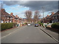
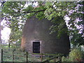
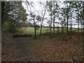
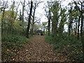
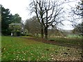
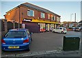
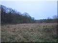
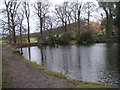
16 photos from this area
Area Information
Key information about the S64 8EB including its size, population, and administrative classification.
- Area Type
- Postcode
- Area Size
- 1.2 hectares
- Population
- 1600
- Population Density
- 1219 people/km²
House Prices in S64 8EB
28
Properties
£164,174
Average Sold Price
£55,000
Lowest Price
£245,000
Highest Price
Showing 28 properties
| Address | Type | Beds | Baths | Last Sale Price | Last Sale Date | |
|---|---|---|---|---|---|---|
| 82 Rockingham Road, Swinton, Rotherham, S64 8EB | Detached | 3 | 2 | £240,000 | Sep 2025 | |
| 110 Rockingham Road, Swinton, Rotherham, S64 8EB | house | - | - | £245,000 | Jul 2025 | |
| 94 Rockingham Road, Swinton, Rotherham, S64 8EB | Semi-detached | - | - | £180,000 | Jul 2023 | |
| 116 Rockingham Road, Swinton, Rotherham, S64 8EB | Semi-detached | 3 | 1 | £220,000 | Jan 2023 | |
| 86 Rockingham Road, Swinton, Rotherham, S64 8EB | Semi-detached | 3 | 1 | £186,000 | Jun 2022 | |
| 90 Rockingham Road, Swinton, Rotherham, S64 8EB | house | - | - | £207,500 | Nov 2021 | |
| 108 Rockingham Road, Swinton, Rotherham, S64 8EB | house | - | - | £205,000 | Sep 2021 | |
| 107 Rockingham Road, Swinton, Rotherham, S64 8EB | house | - | - | £197,000 | Sep 2020 | |
| 96 Rockingham Road, Swinton, Rotherham, S64 8EB | Semi-detached | 3 | 1 | £175,000 | Dec 2019 | |
| 111 Rockingham Road, Swinton, Rotherham, S64 8EB | Semi-detached | 3 | 1 | £174,000 | Oct 2019 |
Page 1 of 3
Energy Efficiency in S64 8EB
Amenities
Schools
| Rank | School | Type | Entry gender | Ages |
|---|
Explore more schools in this area
Go to Schools tabDemographics
Household Size
Two person
most common
Accommodation Type
Houses
most common
Tenure
87
majority
Ethnic Group
White
most common
Religion
N/A
most common
Household Composition
N/A
most common
Age
47
median
Adults (30-64 years)
most common
Household Deprivation
N/A
with no deprivation
NS-SEC
36
in Lower managerial occupations
Explore more demographic insights in this area
Go to Demographics tabPlanning
Planning Constraints
- Flood RiskPremium
- Ramsar Wetland SitesPremium
- Area of Outstanding Natural BeautyPremium
- Protected Nature ReservePremium
- Protected WoodlandPremium