Area Overview for S64 5TZ
Photos of S64 5TZ
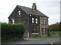
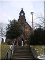
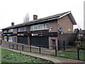
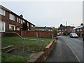
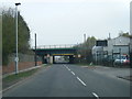
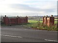
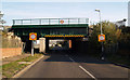
18 photos from this area
Area Information
Key information about the S64 5TZ including its size, population, and administrative classification.
- Area Type
- Postcode
- Area Size
- 8478 m²
- Population
- 2192
- Population Density
- 2950 people/km²
House Prices in S64 5TZ
27
Properties
£104,545
Average Sold Price
£56,000
Lowest Price
£150,000
Highest Price
Showing 27 properties
| Address | Type | Beds | Baths | Last Sale Price | Last Sale Date | |
|---|---|---|---|---|---|---|
| 7 Rix Road, Kilnhurst, Rotherham, S64 5TZ | house | - | - | £128,000 | Jan 2022 | |
| 23 Rix Road, Kilnhurst, Rotherham, S64 5TZ | house | - | - | £150,000 | Apr 2021 | |
| 2 Rix Road, Kilnhurst, Rotherham, S64 5TZ | house | - | - | £115,000 | Oct 2020 | |
| 21 Rix Road, Kilnhurst, Rotherham, S64 5TZ | Semi-detached | 3 | 1 | £137,500 | Jun 2018 | |
| 1 Rix Road, Kilnhurst, Rotherham, S64 5TZ | Semi-detached | 3 | 1 | £68,500 | Mar 2016 | |
| 9 Rix Road, Kilnhurst, Rotherham, S64 5TZ | Semi-detached | 3 | - | £79,950 | Dec 2014 | |
| 6 Rix Road, Kilnhurst, Rotherham, S64 5TZ | Semi-detached | - | - | £90,000 | Sep 2010 | |
| 16 Rix Road, Kilnhurst, Rotherham, S64 5TZ | Semi-detached | 3 | 1 | £107,500 | Jan 2007 | |
| 24 Rix Road, Kilnhurst, Rotherham, S64 5TZ | Semi-detached | - | - | £113,000 | Dec 2004 | |
| Progress House, 17 Rix Road, Kilnhurst, Rotherham, S64 5TZ | Retirement | - | - | £56,000 | May 1999 |
Page 1 of 3
Energy Efficiency in S64 5TZ
Amenities
Schools
| Rank | School | Type | Entry gender | Ages |
|---|
Explore more schools in this area
Go to Schools tabDemographics
Household Size
Family (3-5 people)
most common
Accommodation Type
Houses
most common
Tenure
70
majority
Ethnic Group
White
most common
Religion
N/A
most common
Household Composition
N/A
most common
Age
47
median
Adults (30-64 years)
most common
Household Deprivation
N/A
with no deprivation
NS-SEC
26
in Lower managerial occupations
Explore more demographic insights in this area
Go to Demographics tabPlanning
Planning Constraints
- Flood RiskPremium
- Ramsar Wetland SitesPremium
- Area of Outstanding Natural BeautyPremium
- Protected Nature ReservePremium
- Protected WoodlandPremium